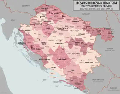
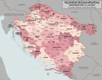
The districts (Croatian: kotar, pl. kotari, German: Bezirk) were the secondary territorial subdivisions of the Independent State of Croatia. There were 139 of them originally, with that number changing after the capitulation of Italy and the discontinuation of the Treaties of Rome. The districts were each a part of a county, and were themselves further divided into municipalities.
Districts from 1941–43

1941–1943
Districts from 1943–45

1943–1945
- ↑ NDH Control of Gruda was not formally recognized by Germany until April 1944
- ↑ Not a county, but a commissariat, was not legally part of the State, but only administered de facto by the Croatian vice-prefect of Rijeka
- ↑ The commissariat was formally an office, ruled by a Croatian commissioner, of the Italian prefecture of Rijeka
References
- Croatia OR 5360 (1:1 000 000) London : War Office, 1941
- Kraljevina Jugoslavija MDR Misc 7596 (1:2 800 000), Great Britain. Army. Royal Engineers. Map Reproduction Section, 1944
- Volkstumskarte von Jugoslawien (1:200 000) Wilfried Krallert, Wien, (1941)
- Encyclopædia Britannica 17th Edition, Austria-Hungary (1:3 800 000), 1905
- Crna Legija website
This article is issued from Wikipedia. The text is licensed under Creative Commons - Attribution - Sharealike. Additional terms may apply for the media files.