| Doi Phu Kha | |
|---|---|
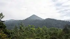 The top of Doi Phu Kha as seen from the park headquarters | |
| Highest point | |
| Elevation | 1,910 m (6,270 ft) |
| Coordinates | 19°11′35″N 101°06′21″E / 19.19306°N 101.10583°E |
| Geography | |
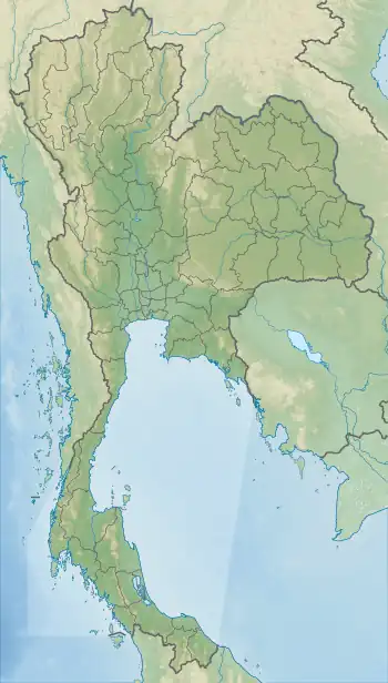 Doi Phu Kha Location in Thailand, on the Lao–Thai border | |
| Location | Thailand |
| Parent range | Luang Prabang Range |
| Climbing | |
| First ascent | unknown |
Doi Phu Kha (Thai: ดอยภูคา) is a mountain in Southeast Asia, part of the Luang Prabang Range (ทิวเขาหลวงพระบาง).[1]
It is a rugged mountain in a forested area of Nan Province, at the east end of the Thai highlands, 18 km west of the border between Laos and Thailand. The Doi Phu Kha National Park, Northern Thailand's largest national park, is in the area surrounding the mountain.[2]
See also
References
- ↑ ดร.กระมล ทองธรรมชาติ และคณะ, สังคมศึกษา ศาสนาและวัฒนธรรม ม.1, สำนักพิมพ์ อักษรเจริญทัศน์ อจท. จำกัด, 2548, หน้า 24-25
- ↑ Doi Phu Kha National Park
External links
Wikimedia Commons has media related to Doi Phu Kha.
This article is issued from Wikipedia. The text is licensed under Creative Commons - Attribution - Sharealike. Additional terms may apply for the media files.