Dolní Kalná | |
|---|---|
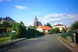 View towards the Church of the Visitation of the Virgin Mary and Saint Wenceslaus | |
 Flag  Coat of arms | |
 Dolní Kalná Location in the Czech Republic | |
| Coordinates: 50°32′20″N 15°38′21″E / 50.53889°N 15.63917°E | |
| Country | |
| Region | Hradec Králové |
| District | Trutnov |
| First mentioned | 1369 |
| Area | |
| • Total | 9.70 km2 (3.75 sq mi) |
| Elevation | 377 m (1,237 ft) |
| Population (2023-01-01)[1] | |
| • Total | 679 |
| • Density | 70/km2 (180/sq mi) |
| Time zone | UTC+1 (CET) |
| • Summer (DST) | UTC+2 (CEST) |
| Postal code | 543 74 |
| Website | www |
Dolní Kalná is a municipality and village in Trutnov District in the Hradec Králové Region of the Czech Republic. It has about 700 inhabitants.
Administrative parts
The village of Slemeno is an administrative part of Dolní Kalná.
References
Wikimedia Commons has media related to Dolní Kalná.
This article is issued from Wikipedia. The text is licensed under Creative Commons - Attribution - Sharealike. Additional terms may apply for the media files.