Domingo Pérez de Granada | |
|---|---|
.svg.png.webp) Flag .svg.png.webp) Coat of arms | |
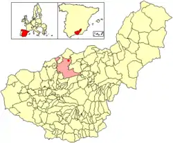 Location of Domingo Pérez de Granada | |
 Domingo Pérez de Granada Location in Spain | |
| Coordinates: 37°29′51″N 3°30′27″W / 37.49750°N 3.50750°W | |
| Country | |
| Autonomous community | |
| Province | Granada |
| Comarca | Los Montes |
| Judicial district | Granada |
| Government | |
| • Alcalde | Eloy Vera (PSOE) |
| Area | |
| • Total | 50 km2 (20 sq mi) |
| Elevation | 981 m (3,219 ft) |
| Population (2018)[1] | |
| • Total | 890 |
| • Density | 18/km2 (46/sq mi) |
| Demonym(s) | Pereño, -ña |
| Time zone | UTC+1 (CET) |
| • Summer (DST) | UTC+2 (CEST) |
| Postal code | 18567 |
| Dialing code | +34 958 |
Domingo Pérez de Granada is a village and municipality of Granada province, Spain, placed at 46 kilometers from Granada.
This village has many accesses: in the north, Montejícar and others villages of Jaén as Huelma, Cambil, and Arbuniel; In the east way is near to Píñar; and south access the old road to Granada, that joins it to Píñar, Iznalloz and Deifontes.
References
- ↑ Municipal Register of Spain 2018. National Statistics Institute.
External links
This article is issued from Wikipedia. The text is licensed under Creative Commons - Attribution - Sharealike. Additional terms may apply for the media files.