Dongqiao | |
|---|---|
Village | |
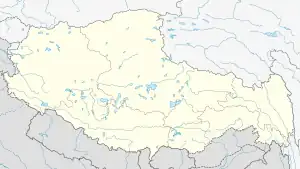
 Dongqiao Location within Tibet | |
| Coordinates: 31°50′56.2″N 90°35′6.3″E / 31.848944°N 90.585083°E | |
| Country | People's Republic of China |
| Region | Tibet |
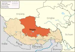
| Prefecture | Nagqu Prefecture |
| County | Amdo County |
| Population | |
| • Major Nationalities | Tibetan |
| • Regional dialect | Tibetan language |
| Time zone | +8 |
Dongqiao (Chinese: 东巧) is a village in Amdo County of Nagqu Prefecture, Tibet Autonomous Region, People's Republic of China. The village of Dongqiao is noted for its hot spring, Jipu. Dongqiao geologically gives its name to the wider Dongqiao-Nagqu Subregion and the Banggong-Dongqiao-Nujiang fault zone.
Geography and geology
Dongqiao is located about 90 kilometres (56 mi) west of Amdo Town.[1] It is located several kilometres to the south of Qiangma and Zigetangcuo Lake, to the northeast of Dongqiacuo lake at an altitude of about 4,657 metres (15,279 ft).[2][3] The Nu River, also known as the Nujiang River flows nearby forming a valley and the Nutiang River also flows nearby.[4][5][6] A small valley is located 7 kilometres (4.3 mi) southeast of Dongqiao.[7] Dongqiao village gives its name to a large region which it is located in which is known geologically for its ophiolite, termed the "Dongqiao ophiolite belt", which is dated to the late Jurassic to early Cretaceous age.[8][9][10] The Jurassic age formations form three distinct geological regions to the north of Lhasa, from north to south the Dongqiao-Nagqu Subregion, the Doilungdeqen-Lhunzhub Subregion and the Sangri Subregion.[11] The northern boundary is known as the Banggong-Dongqiao-Nujiang fault zone or Bangongcuo-Dingqing fault zone, which divides it from the Qiangtang Terrane to the north beyond this.[12][11] Towards the end of the Jurassic period, the ophiolite became covered by chromitite.[4] As Guangcen Li puts it in a 1990 paper, "the ophiolites appear to be covered in turn by a transgressive marine detrital Upper Jurassic to lower most Cretaceous series."[13]
The Chinese Academy of Geological Sciences has conducted studies in the area, identifying "diamond orebodies of diamondiferous ultrabasic rock type in Dongqiao and Lhobsa of Amdo County, northern Tibet."[1] The village of Dongqiao is noted for its hot spring, Jipu.[14]
Economy
Due to its geological background, Dongqiao is also a known mining spot, containing the Dongfeng Chrome Mine.[15]
References
- 1 2 Liu, Nailong (1996). Mineral deposits of China. Geological Pub. House. p. 159. ISBN 978-7-116-02076-4. Retrieved 22 July 2012.
- ↑ "Maps". Google, Inc. Retrieved 21 July 2012.
- ↑ "Dongqiao". GeoNames. Retrieved 22 July 2012.
- 1 2 European Space Agency; IEEE Geoscience and Remote Sensing Society (2003). IGARSS. ESA Scientific & Technical Publications Branch. p. 2596. Retrieved 22 July 2012.
- ↑ Universität zu Köln. Geologisches Institut (1994). Sonderveröffentlichungen des Geologischen Instituts der Universität Köln. Universität Köln. Retrieved 22 July 2012.
- ↑ Abstracts: 30th International Geological Congress, Beijing, China, 4-14 August 1996. The Congress. 1996. p. 304. Retrieved 22 July 2012.
- ↑ Chengfa Chang; Royal Society (Great Britain); Zhongguo ke xue yuan (1988). The geological evolution of Tibet: report of the 1985 Royal Society-Academia Sinica Geotraverse of the Qinghai-Xizang Plateau. Royal Society. p. 93. ISBN 978-0-85403-362-1. Retrieved 22 July 2012.
- ↑ Sharma, Kaushal Kishore (1991). Geology and geodynamic evolution of the Himalayan collision zone. Pergamon Press. p. 212. Retrieved 22 July 2012.
- ↑ Zhang, Shouxin (18 September 2009). Geological Formation Names of China (1866-2000). Springer. p. 251. ISBN 978-3-540-93823-1. Retrieved 22 July 2012.
- ↑ Burtman, Valentin Semenovich; Molnar, Peter Hale (1993). Geological and Geophysical Evidence for Deep Subduction of Continental Crust Beneath the Pamir. Geological Society of America. p. 10. ISBN 978-0-8137-2281-8. Retrieved 22 July 2012.
- 1 2 Chengfa Chang; Royal Society (Great Britain); Zhongguo ke xue yuan (1988). The geological evolution of Tibet: report of the 1985 Royal Society-Academia Sinica Geotraverse of the Qinghai-Xizang Plateau. Royal Society. p. 34. ISBN 978-0-85403-362-1. Retrieved 22 July 2012.
- ↑ Wiley, Thomas J.; Howell, D. G.; Wong, Florence L. (1990). Terrane analysis of China and the Pacific Rim. Circum-Pacific Council for Energy and Mineral Resources. p. 239. ISBN 978-0-933687-14-1. Retrieved 22 July 2012.
- ↑ Li, Guangcen (1990). Geology of the Himalayas: Papers on geology. Geological Publishing House. p. 104. ISBN 978-7-116-00748-2. Retrieved 22 July 2012.
- ↑ Zheng, Mianping (1997). An Introduction to Saline Lakes on the Qinghai-Tibet Plateau. Springer. p. 110. ISBN 978-0-7923-4098-0. Retrieved 22 July 2012.
- ↑ China. 冶金工业部 (1994). Zhongguo gang tie gong ye nian jian. Ye jin gong ye chu ban she. Retrieved 22 July 2012.
