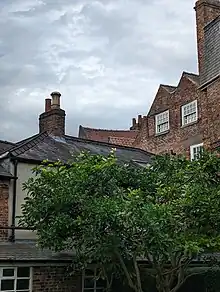
The Eagle & Child is a pub on High Petergate, in the city centre of York, in England.
The building was constructed in the early 17th-century, as a three-storey timber-framed building, with attics and a jettied front. In the 18th-century, the building was altered internally, and a brick extension was added at the rear, shared with the neighbouring Petergate House. The building's staircase survives from this period. Late that century, bays were added at the front, which survive at the first- and second-floor levels. There is a large chimney between the front and rear rooms of the original part of the building, with fireplaces surviving from the 17th-, 18th- and early-19th centuries. The building was further altered in the 20th-century, and the ground floor shopfront dates from this era.[1][2]

By the mid-1960s, the building was a restaurant, when the Rolling Stones signed their names in lipstick on the wall of the top floor, graffiti which has been preserved.[3] In 1977, the restaurant became Plunketts, which operated until 2015. That year, the Leeds Brewery converted it into the Eagle & Child pub, the name taken from a pub which operated on The Shambles from the 1700s until 1925.[4][5] In 2017, it was taken over by Camerons Brewery, who refurbished the pub.[6]
The building has been grade II* listed since 1954.[1]
References
- 1 2 "Number 9 And Attached Outbuildings / 8 High Petergate / Cottage At Rear Of Number 11". Historic England. Retrieved 18 January 2022.
- ↑ An Inventory of the Historical Monuments in City of York, Volume 5, Central. London: HMSO. 1981. Retrieved 7 August 2020.
- ↑ Graham, Andrew (2018). York in 50 Buildings. Amberley Publishing. ISBN 9781445674094.
- ↑ "Ancient name to be revived at York's next new pub". The Press. 14 October 2015. Retrieved 18 January 2022.
- ↑ "New pub opens in York". The Press. 20 November 2015. Retrieved 18 January 2022.
- ↑ "11 pix inside one of York's most historic pubs after its refurb". York Mix. 4 October 2017. Retrieved 18 January 2022.