Municipal District of Peace No. 135 | |
|---|---|
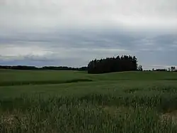 Grain fields in the Peace Country | |
|
Logo | |
 Location within Alberta | |
| Country | Canada |
| Province | Alberta |
| Region | Northern Alberta |
| Census division | 19 |
| Established | 1916 |
| Incorporated | 1945 |
| Government | |
| • Reeve | Robert Willing |
| • Governing body | MD of Peace Council |
| • Administrative office | adjacent to Berwyn |
| Area (2021)[2] | |
| • Land | 847.22 km2 (327.11 sq mi) |
| Population (2021)[2] | |
| • Total | 1,581 |
| • Density | 1.9/km2 (5/sq mi) |
| Time zone | UTC−7 (MST) |
| • Summer (DST) | UTC−6 (MDT) |
| Website | mdpeace.com |

The Municipal District of Peace No. 135 is a municipal district (MD) in northwestern Alberta, Canada. Located in Census Division No. 19, its municipal office is located outside but adjacent to the Village of Berwyn.
Geography
Communities and localities
|
The following urban municipalities are surrounded by the MD of Peace No. 135.[3]
The following hamlets are located within the MD of Peace No. 135.[3] |
The following localities are located within the MD of Peace No. 135.[4]
|
Demographics
| Year | Pop. | ±% |
|---|---|---|
| 1916 | 918 | — |
| 1921 | 1,337 | +45.6% |
| 1926 | 1,377 | +3.0% |
| 1931 | 1,990 | +44.5% |
| 1936 | 2,155 | +8.3% |
| 1941 | 2,003 | −7.1% |
| 1946 | 1,791 | −10.6% |
| 1951 | 1,741 | −2.8% |
| 1956 | 1,732 | −0.5% |
| 1961 | 1,917 | +10.7% |
| 1966 | 1,745 | −9.0% |
| 1971 | 1,624 | −6.9% |
| 1976 | 1,583 | −2.5% |
| 1981 | 1,520 | −4.0% |
| 1986 | 1,527 | +0.5% |
| 1991 | 1,481 | −3.0% |
| 1996 | 1,562 | +5.5% |
| 2001 | 1,496 | −4.2% |
| 2006 | 1,487 | −0.6% |
| 2011 | 1,446 | −2.8% |
| 2016 | 1,747 | +20.8% |
| Source: Statistics Canada [5][6][7][8][9][10][11][12][13][14][15] | ||
In the 2021 Census of Population conducted by Statistics Canada, the MD of Peace No. 135 had a population of 1,581 living in 577 of its 654 total private dwellings, a change of -9.8% from its 2016 population of 1,752. With a land area of 847.22 km2 (327.11 sq mi), it had a population density of 1.9/km2 (4.8/sq mi) in 2021.[2]
In the 2016 Census of Population conducted by Statistics Canada, the MD of Peace No. 135 had a population of 1,747 living in 578 of its 639 total private dwellings, a 20.8% change from its 2011 population of 1,446. With a land area of 847.47 km2 (327.21 sq mi), it had a population density of 2.1/km2 (5.3/sq mi) in 2016.[16]
Economy
Agriculture is a significant part of the area's economy, with the region being dubbed as most northern agricultural industry oasis in the world.[17] The region has unique growing combination of a northern climate, fertile soils, and a watershed system fed by glacial run offs.
Attractions
See also
References
- ↑ "Municipal Officials Search". Alberta Municipal Affairs. May 9, 2019. Retrieved October 1, 2021.
- 1 2 3 "Population and dwelling counts: Canada, provinces and territories, and census subdivisions (municipalities)". Statistics Canada. February 9, 2022. Retrieved February 9, 2022.
- 1 2 "Specialized and Rural Municipalities and Their Communities" (PDF). Alberta Municipal Affairs. January 12, 2022. Retrieved January 21, 2022.
- ↑ "Standard Geographical Classification (SGC) 2006, Economic Regions: 4819071 - Peace No. 135, geographical codes and localities, 2006". Statistics Canada. March 5, 2010. Retrieved August 12, 2012.
- ↑ "Table IV: Population of Prairie Provinces by Municipalities, Local Improvement Districts or Unorganized Territorial Units, 1916". Census of Prairie Provinces, 1916. Ottawa: Department of Trade and Commerce. 1918.
- ↑ "Table 6: Population by census divisions of Alberta classified by municipalities for census years, 1921 and 1926". Census of Prairie Provinces, 1926. Ottawa: Department of Trade and Commerce. 1929.
- ↑ "Table 6: Population by census subdivisions, 1926-1946". Census of the Prairie Provinces, 1946. Vol. I: Population. Ottawa: Dominion Bureau of Statistics. 1949.
- ↑ "Table 6: Population by sex, for census subdivisions, 1956 and 1951". Census of Canada, 1956. Vol. I: Population. Ottawa: Dominion Bureau of Statistics. 1958.
- ↑ "Table 9: Population by census subdivisions, 1966 by sex, and 1961". 1966 Census of Canada. Western Provinces. Vol. Population: Divisions and Subdivisions. Ottawa: Dominion Bureau of Statistics. 1967.
- ↑ "Table 3: Population for census divisions and subdivisions, 1971 and 1976". 1976 Census of Canada. Census Divisions and Subdivisions, Western Provinces and the Territories. Vol. Population: Geographic Distributions. Ottawa: Statistics Canada. 1977.
- ↑ "Table 2: Census Subdivisions in Alphabetical Order, Showing Population Rank, Canada, 1981". 1981 Census of Canada. Vol. Census subdivisions in decreasing population order. Ottawa: Statistics Canada. 1982. ISBN 0-660-51563-6.
- ↑ "Table 2: Population and Dwelling Counts, for Census Divisions and Census Subdivisions, 1986 and 1991 – 100% Data". 91 Census. Vol. Population and Dwelling Counts – Census Divisions and Census Subdivisions. Ottawa: Statistics Canada. 1992. pp. 100–108. ISBN 0-660-57115-3.
- ↑ "Population and Dwelling Counts, for Canada, Provinces and Territories, and Census Divisions, 2001 and 1996 Censuses – 100% Data (Alberta)". Statistics Canada. Retrieved May 28, 2019.
- ↑ "Population and dwelling counts, for Canada, provinces and territories, and census subdivisions (municipalities), 2006 and 2001 censuses – 100% data (Alberta)". Statistics Canada. January 6, 2010. Retrieved May 28, 2019.
- ↑ "Census Profile, 2016 Census". Statistics Canada. February 8, 2017. Retrieved May 28, 2019.
- ↑ "Population and dwelling counts, for Canada, provinces and territories, and census subdivisions (municipalities), 2016 and 2011 censuses – 100% data (Alberta)". Statistics Canada. February 8, 2017. Retrieved February 8, 2017.
- ↑ "Defining Quality of Peace Country Agriculture" (PDF). Branding the Peace Country Association. April 2009. Archived from the original (PDF) on October 3, 2011. Retrieved March 23, 2011.
External links
Places adjacent to Municipal District of Peace No. 135 | |
|---|---|