| East Branch Tunungwant Creek Tributary to Tunungwant Creek | |
|---|---|
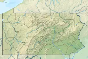
 Location of East Branch Tunungwant Creek mouth  East Branch Tunungwant Creek (the United States) | |
| Location | |
| Country | United States |
| State | Pennsylvania |
| County | McKean |
| City | Bradford |
| Physical characteristics | |
| Source | Panther Run divide |
| • location | about 0.5 miles west-southwest of Cyclone, Pennsylvania |
| • coordinates | 41°49′43.33″N 078°35′40.09″W / 41.8287028°N 78.5944694°W[1] |
| • elevation | 2,158 ft (658 m)[1] |
| Mouth | Tunungwant Creek |
• location | Bradford, Pennsylvania |
• coordinates | 41°57′28.23″N 078°38′29.10″W / 41.9578417°N 78.6414167°W[1] |
• elevation | 1,421 ft (433 m)[1] |
| Length | 12.30 mi (19.79 km)[2] |
| Basin size | 58.05 square miles (150.3 km2)[3] |
| Discharge | |
| • location | Tunungwant Creek |
| • average | 115.57 cu ft/s (3.273 m3/s) at mouth with Tunungwant Creek[3] |
| Basin features | |
| Progression | Tunungwant Creek → Allegheny River → Ohio River → Mississippi River → Gulf of Mexico |
| River system | Allegheny River |
| Tributaries | |
| • left | Bear Run Lewis Run Foster Run Watrous Run Sheppard Run |
| • right | Railroad Run Minard Run Rutherford Run |
| Bridges | Droney Road, Main Street, Browntown Road, E Warren Road, Minard Run Road, Owens Way, Elm Street, Main Street |
East Branch Tunungwant Creek is a 12.30 mi (19.79 km) long fourth-order tributary to Tunungwant Creek.[2] This is the only stream of this name in the United States.[1]
Course
East Branch Tunungwant Creek rises about 0.5 miles (0.80 km) southwest of Cyclone, Pennsylvania, and then flows generally north to meet Tunungwant Creek at Bradford, Pennsylvania to form Tunungwant Creek with West Branch Tunungwant Creek.
Watershed
East Branch Tunungwant Creek drains 58.05 square miles (150.3 km2) of area, receives about 46.6 in/year (118 cm/year) of precipitation, and is about 81.18% forested.[3]
See also
External links
References
- 1 2 3 4 5 "Geographic Names Information System". edits.nationalmap.gov. US Geological Survey. Retrieved January 23, 2023.
- 1 2 "ArcGIS Web Application". epa.maps.arcgis.com. US EPA. Retrieved January 23, 2023.
- 1 2 3 "Watershed Report | Office of Water | US EPA". watersgeo.epa.gov. US EPA. Retrieved January 23, 2023.
This article is issued from Wikipedia. The text is licensed under Creative Commons - Attribution - Sharealike. Additional terms may apply for the media files.