East Derwent Highway | |
|---|---|
 | |
| East Derwent Highway at Geilston Bay | |
 North end South end | |
| Coordinates | |
| General information | |
| Type | Highway |
| Length | 22.5 km (14 mi)[1] |
| Route number(s) | |
| Major junctions | |
| North end | Bridgewater, Tasmania |
| |
| South end | Rose Bay, Tasmania |
| Location(s) | |
| Region | Hobart |
| Major suburbs | Gagebrook, Old Beach, Otago, Geilston Bay, Lindisfarne |
| Highway system | |
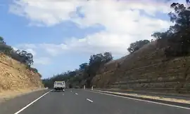
The East Derwent Highway (route number B32) is a highway in Hobart, Tasmania, Australia. The highway is a trunk road that carries heavy commuter traffic, much like the Brooker Highway, on the eastern side of the River Derwent.
Route
The highway starts at the roundabout with Midland Highway at Bridgewater and heads south as a dual-lane, single carriageway road, connecting with the Bowen Bridge over the River Derwent, widening to a four-lane, dual-carriageway road through Risdon, narrowing again to a dual-lane, single-carriageway road through Geilston Bay, and then widening to a four-lane, single-carriageway road to eventually terminate at the Lindisfarne Interchange at Rose Bay, near the eastern side of the Tasman Bridge leading into central Hobart.
Exits and intersections
| LGA[1] | Location[1] | km[1] | mi | Destinations | Notes |
|---|---|---|---|---|---|
| Brighton | Bridgewater | 0.0 | 0.0 | Northern terminus of highway and route B32 at roundabout | |
| 0.4 | 0.25 | ||||
| Jordan River | 2.2 | 1.4 | Jordan River Bridge | ||
| Brighton | Old Beach | 5.9 | 3.7 | ||
| 7.7 | 4.8 | ||||
| Clarence | Risdon | 13.6 | 8.5 | ||
| Risdon Vale | 15.9 | 9.9 | |||
| Lindisfarne | 20.6 | 12.8 | Gordons Hill Road – Rosny, Mornington | ||
| Rose Bay | 22.5 | 14.0 | Southern terminus of highway and route B32 at Lindisfarne Interchange | ||
| |||||
See also
References
- 1 2 3 4 Google (26 May 2022). "East Derwent Highway" (Map). Google Maps. Google. Retrieved 26 May 2022.
- Shipway, Jesse (2002). "A plural line of sight: An essay on Tasmanian modernity". Island (88): 109–118. ISSN 1035-3127.
External links
![]() Media related to East Derwent Highway at Wikimedia Commons
Media related to East Derwent Highway at Wikimedia Commons