East Jordan, Michigan | |
|---|---|
| City of East Jordan | |
 Looking north along Main Street | |
| Motto(s): "Where River, Lake, and Friendly People Meet" | |
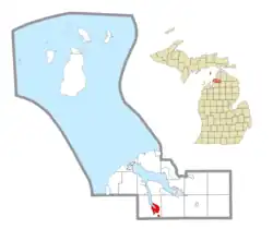
 Location within Charlevoix County | |
 East Jordan Location within the state of Michigan  East Jordan Location within the United States | |
| Coordinates: 45°09′21″N 85°07′41″W / 45.15583°N 85.12806°W | |
| Country | United States |
| State | Michigan |
| County | Charlevoix |
| Settled | 1873 |
| Incorporated | 1887 (village) 1911 (city) |
| Government | |
| • Type | City commission |
| • Mayor | Mark Penzein |
| • Administrator | Tom Cannon |
| • Clerk | Cheltzi Wilson |
| Area | |
| • Total | 3.92 sq mi (10.15 km2) |
| • Land | 3.00 sq mi (7.77 km2) |
| • Water | 0.92 sq mi (2.38 km2) |
| Elevation | 646 ft (197 m) |
| Population (2020) | |
| • Total | 2,239 |
| • Density | 746.33/sq mi (288.19/km2) |
| Time zone | UTC-5 (Eastern (EST)) |
| • Summer (DST) | UTC-4 (EDT) |
| ZIP code(s) | 49727 |
| Area code | 231 |
| FIPS code | 26-24020[4] |
| GNIS feature ID | 0625200[3] |
| Website | Official website |

East Jordan is a city in Charlevoix County in the U.S. state of Michigan. The population was 2,239 at the 2020 census.
The city is at the end of the south arm of Lake Charlevoix at the mouth of the Jordan River. The corporate headquarters of EJ, an international company formerly known as East Jordan Iron Works, is located in East Jordan. EJ was founded in East Jordan in 1883.
History
The area was first settled by Canadian William Empey in 1873. He built the first store here in 1874 at the mouth of the Jordan River at the southernmost point of Lake Charlevoix. He became the first postmaster when a post office opened on May 31, 1878. The community absorbed the nearby village of South Arm and incorporated as the village of East Jordan in 1887. It incorporated as a city in 1911.[5]
East Jordan grew quickly, and by 1890, it boasted a large ironworks company now known as EJ. The city was serviced by two railroads. With these two railroad connections, and the ability to ship cargo up Lake Charlevoix to Lake Michigan, East Jordan quickly grew into a major manufacturing center. To this day, four industrial corporations still operate within the town. In 1899, the Detroit and Charlevoix Railroad built their mainline through the East side of the city, and in 1901, the East Jordan and Southern Railroad began operations on the western end of the city. In 1932, the Detroit and Charlevoix was abandoned, and the East Jordan and Southern closed in 1961 after the East Jordan Iron Works ended shipping by rail.
East Jordan contains two listing on the National Register of Historic Places. The East Jordan Lumber Company Store Building and the Votruba Block were both built in 1899 and are located next to each other in the city's downtown area.
Geography
According to the U.S. Census Bureau, the city has a total area of 3.92 square miles (10.15 km2), of which 3.00 square miles (7.77 km2) is land and 0.92 square miles (2.38 km2) (23.47%) is water.[2]
The city boundaries contain an exclave which is used to incorporate the East Jordan City Airport to the southeast of the city.
Major highways
Climate
This climatic region has large seasonal temperature differences, with warm to hot (and often humid) summers and cold (sometimes severely cold) winters. According to the Köppen Climate Classification system, East Jordan has a humid continental climate, abbreviated "Dfb" on climate maps.[6]
| Climate data for East Jordan, Michigan (1991–2020 normals, extremes 1926–present) | |||||||||||||
|---|---|---|---|---|---|---|---|---|---|---|---|---|---|
| Month | Jan | Feb | Mar | Apr | May | Jun | Jul | Aug | Sep | Oct | Nov | Dec | Year |
| Record high °F (°C) | 55 (13) |
65 (18) |
87 (31) |
90 (32) |
97 (36) |
102 (39) |
103 (39) |
100 (38) |
97 (36) |
88 (31) |
78 (26) |
65 (18) |
103 (39) |
| Mean daily maximum °F (°C) | 30.4 (−0.9) |
32.9 (0.5) |
42.9 (6.1) |
56.0 (13.3) |
70.0 (21.1) |
79.2 (26.2) |
82.6 (28.1) |
80.9 (27.2) |
73.7 (23.2) |
60.3 (15.7) |
46.5 (8.1) |
35.4 (1.9) |
57.6 (14.2) |
| Daily mean °F (°C) | 22.7 (−5.2) |
23.6 (−4.7) |
32.0 (0.0) |
43.6 (6.4) |
55.7 (13.2) |
65.0 (18.3) |
68.9 (20.5) |
67.4 (19.7) |
60.6 (15.9) |
49.4 (9.7) |
38.4 (3.6) |
28.8 (−1.8) |
46.3 (7.9) |
| Mean daily minimum °F (°C) | 15.1 (−9.4) |
14.2 (−9.9) |
21.1 (−6.1) |
31.2 (−0.4) |
41.4 (5.2) |
50.8 (10.4) |
55.2 (12.9) |
53.8 (12.1) |
47.5 (8.6) |
38.4 (3.6) |
30.3 (−0.9) |
22.3 (−5.4) |
35.1 (1.7) |
| Record low °F (°C) | −36 (−38) |
−41 (−41) |
−29 (−34) |
−7 (−22) |
13 (−11) |
26 (−3) |
33 (1) |
30 (−1) |
23 (−5) |
15 (−9) |
−14 (−26) |
−31 (−35) |
−41 (−41) |
| Average precipitation inches (mm) | 2.04 (52) |
1.34 (34) |
1.54 (39) |
2.52 (64) |
2.98 (76) |
3.15 (80) |
2.90 (74) |
3.26 (83) |
3.74 (95) |
4.37 (111) |
2.76 (70) |
2.24 (57) |
32.84 (834) |
| Average snowfall inches (cm) | 37.4 (95) |
23.1 (59) |
11.0 (28) |
4.6 (12) |
0.0 (0.0) |
0.0 (0.0) |
0.0 (0.0) |
0.0 (0.0) |
0.0 (0.0) |
0.7 (1.8) |
10.0 (25) |
35.4 (90) |
122.2 (310) |
| Average precipitation days (≥ 0.01 in) | 17.3 | 12.4 | 9.5 | 11.4 | 11.5 | 10.4 | 9.8 | 10.0 | 11.3 | 14.6 | 14.6 | 16.1 | 148.9 |
| Average snowy days (≥ 0.1 in) | 15.6 | 11.0 | 5.5 | 2.2 | 0.1 | 0.0 | 0.0 | 0.0 | 0.0 | 0.4 | 5.0 | 12.5 | 52.3 |
| Source: NOAA[7][8] | |||||||||||||
Demographics
| Census | Pop. | Note | %± |
|---|---|---|---|
| 1890 | 731 | — | |
| 1900 | 1,205 | 64.8% | |
| 1910 | 2,516 | 108.8% | |
| 1920 | 2,428 | −3.5% | |
| 1930 | 1,523 | −37.3% | |
| 1940 | 1,725 | 13.3% | |
| 1950 | 1,779 | 3.1% | |
| 1960 | 1,919 | 7.9% | |
| 1970 | 2,041 | 6.4% | |
| 1980 | 2,185 | 7.1% | |
| 1990 | 2,240 | 2.5% | |
| 2000 | 2,507 | 11.9% | |
| 2010 | 2,351 | −6.2% | |
| 2020 | 2,239 | −4.8% | |
| U.S. Decennial Census[9] | |||
2010 census
As of the census[10] of 2010, there were 2,351 people, 952 households, and 613 families residing in the city. The population density was 770.8 inhabitants per square mile (297.6/km2). There were 1,189 housing units at an average density of 389.8 per square mile (150.5/km2). The racial makeup of the city was 96.0% White, 0.2% African American, 1.6% Native American, 0.1% Asian, 0.3% from other races, and 1.8% from two or more races. Hispanic or Latino people of any race were 2.3% of the population.
There were 952 households, of which 35.6% had children under the age of 18 living with them, 43.2% were married couples living together, 14.3% had a female householder with no husband present, 6.9% had a male householder with no wife present, and 35.6% were non-families. 29.7% of all households were made up of individuals, and 13.5% had someone living alone who was 65 years of age or older. The average household size was 2.46 and the average family size was 3.01.
The median age in the city was 37.1 years. 27.1% of residents were under the age of 18; 7.8% were between the ages of 18 and 24; 25.4% were from 25 to 44; 24.5% were from 45 to 64; and 15.2% were 65 years of age or older. The gender makeup of the city was 48.7% male and 51.3% female.
2000 census
As of the census[4] of 2000, there were 2,507 people, 946 households, and 658 families residing in the city. The population density was 818.7 inhabitants per square mile (316.1/km2). There were 1,083 housing units at an average density of 353.7 per square mile (136.6/km2). The racial makeup of the city was 94.38% White, 0.40% African American, 1.76% Native American, 0.16% Asian, 0.76% from other races, and 2.55% from two or more races. Hispanic or Latino people of any race were 1.60% of the population.
There were 946 households, out of which 36.9% had children under the age of 18 living with them, 50.1% were married couples living together, 13.4% had a female householder with no husband present, and 30.4% were non-families. 25.7% of all households were made up of individuals, and 11.2% had someone living alone who was 65 years of age or older. The average household size was 2.63 and the average family size was 3.11.
In the city, the population was spread out, with 30.5% under the age of 18, 8.9% from 18 to 24, 28.6% from 25 to 44, 17.4% from 45 to 64, and 14.6% who were 65 years of age or older. The median age was 33 years. For every 100 females, there were 94.5 males. For every 100 females age 18 and over, there were 87.8 males.
The median income for a household in the city was $35,924, and the median income for a family was $39,669. Males had a median income of $31,597 versus $20,385 for females. The per capita income for the city was $14,920. About 7.5% of families and 10.6% of the population were below the poverty line, including 12.5% of those under age 18 and 10.2% of those age 65 or over.
Education

East Jordan is served by its own school district, East Jordan Public Schools, which is centered in the city and serves larger portions of serveral townships.[11]
References
- ↑ City of East Jordan (2022). "East Jordan city officials". Retrieved August 2, 2022.
- 1 2 "2020 U.S. Gazetteer Files". United States Census Bureau. Retrieved May 21, 2022.
- 1 2 U.S. Geological Survey Geographic Names Information System: East Jordan, Michigan
- 1 2 "U.S. Census website". United States Census Bureau. Retrieved 2008-01-31.
- ↑ Romig, Walter (October 1, 1986) [1973]. Michigan Place Names: The History of the Founding and the Naming of More Than Five Thousand Past and Present Michigan Communities (Paperback). Detroit, Michigan: Wayne State University Press. p. 170. ISBN 978-0-8143-1838-6.
{{cite book}}:|work=ignored (help) - ↑ Climate Summary for East Jordan, Michigan
- ↑ "NowData - NOAA Online Weather Data". National Oceanic and Atmospheric Administration. Retrieved August 28, 2021.
- ↑ "Station: E Jordan, MI". U.S. Climate Normals 2020: U.S. Monthly Climate Normals (1991-2020). National Oceanic and Atmospheric Administration. Retrieved August 28, 2021.
- ↑ "Census of Population and Housing". Census.gov. Retrieved June 4, 2015.
- ↑ "U.S. Census website". United States Census Bureau. Retrieved 2012-11-25.
- ↑ Michigan Geographic Framework (15 November 2013). "Charlevoix County School Districts" (PDF). Archived (PDF) from the original on 2014-08-20. Retrieved August 6, 2022.
