Ecseg | |
|---|---|
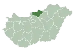
 Ecseg Location of Ecseg | |
| Coordinates: 47°53′49″N 19°36′15″E / 47.89708°N 19.60412°E | |
| Country | |
| County | Nógrád |
| Area | |
| • Total | 24.1 km2 (9.3 sq mi) |
| Population (2004) | |
| • Total | 1,273 |
| • Density | 52.82/km2 (136.8/sq mi) |
| Time zone | UTC+1 (CET) |
| • Summer (DST) | UTC+2 (CEST) |
| Postal code | 3053 |
| Area code | 32 |
Ecseg is a village in Nógrád county, Hungary.
| Year | Population |
|---|---|
| 1870 | 1779 |
| 1880 | 1660 |
| 1890 | 1776 |
| 1900 | 1744 |
| 1910 | 1648 |
| 1920 | 1781 |
| 1930 | 1760 |
| 1941 | 1842 |
| 1949 | 1834 |
| 1960 | 1749 |
| 1970 | 1628 |
| 1980 | 1594 |
| 1990 | 1436 |
| 2001 | 1293 |
| 2011 | 1193 |

Aerial photography: Ecseg, castle ruins
References
- ↑ "Nógrád county - Data on localities - Population number, population density". Hungarian Central Statistical Office/Központi Statisztikai Hivatal. Retrieved 2021-05-22.
External links
- Street map (in Hungarian)

This article is issued from Wikipedia. The text is licensed under Creative Commons - Attribution - Sharealike. Additional terms may apply for the media files.