El Bruc | |
|---|---|
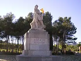 "The Drummer" monument, el Bruc | |
.svg.png.webp) Coat of arms | |
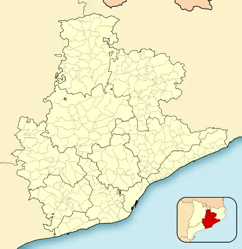 El Bruc Location in Catalonia  El Bruc El Bruc (Spain) | |
| Coordinates: 41°34′57″N 1°46′52″E / 41.58250°N 1.78111°E | |
| Country | |
| Community | |
| Province | Barcelona |
| Comarca | Anoia |
| Government | |
| • Mayor | Enric Canela Vallès (2015)[1] |
| Area | |
| • Total | 47.2 km2 (18.2 sq mi) |
| Elevation | 489 m (1,604 ft) |
| Population (2018)[3] | |
| • Total | 2,027 |
| • Density | 43/km2 (110/sq mi) |
| Demonym(s) | Bruquetà, bruquetana |
| Website | www |
El Bruc (Catalan pronunciation: [əl ˈβɾuk]; Spanish: Bruch) is a municipality in the comarca of the Anoia in Catalonia, Spain. It is situated on the side of Montserrat, of which the north-western third is within the municipality. A local road connects the village with the main N-II road from Barcelona to Lleida, and to Monistrol de Montserrat via the monastery.
It was the site of the Battles of the Bruch between France and Spain in 1808.
Demography
| 1900 | 1930 | 1950 | 1970 | 1986 | 2007 |
|---|---|---|---|---|---|
| 1186 | 1053 | 798 | 774 | 707 | 1743 |
References
- ↑ "Ajuntament del Bruc". Generalitat of Catalonia. Retrieved 2015-11-13.
- ↑ "El municipi en xifres: El Bruc". Statistical Institute of Catalonia. Retrieved 2015-11-23.
- ↑ Municipal Register of Spain 2018. National Statistics Institute.
External links
Wikimedia Commons has media related to El Bruc.
- Official website (in Catalan)
- Government data pages (in Catalan)
Places adjacent to El Bruc | |
|---|---|
.svg.png.webp)
This article is issued from Wikipedia. The text is licensed under Creative Commons - Attribution - Sharealike. Additional terms may apply for the media files.