El Calvario | |
|---|---|
Municipality and town | |
.svg.png.webp) Flag .svg.png.webp) Seal | |
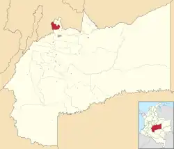 Location of the municipality and town of El Calvario in the Meta Department of Colombia. | |
| Country | |
| Department | Meta Department |
| Elevation | 1,987 m (6,519 ft) |
| Time zone | UTC-5 (Colombia Standard Time) |
| Climate | Af/Cfb |
El Calvario is a town and municipality in the Meta Department, Colombia. It was the epicenter of the 2008 Colombia earthquake.
Climate
El Calvario has a borderline subtropical highland climate (Köppen Cfb)/tropical rainforest climate (Af) with mild mornings, warm afternoons and heavy to very heavy rainfall year-round.
| Climate data for El Calvario | |||||||||||||
|---|---|---|---|---|---|---|---|---|---|---|---|---|---|
| Month | Jan | Feb | Mar | Apr | May | Jun | Jul | Aug | Sep | Oct | Nov | Dec | Year |
| Mean daily maximum °C (°F) | 23.8 (74.8) |
24.1 (75.4) |
24.1 (75.4) |
23.5 (74.3) |
23.0 (73.4) |
22.1 (71.8) |
22.2 (72.0) |
22.4 (72.3) |
22.8 (73.0) |
23.1 (73.6) |
22.9 (73.2) |
23.1 (73.6) |
23.1 (73.6) |
| Daily mean °C (°F) | 18.1 (64.6) |
18.6 (65.5) |
19.2 (66.6) |
19.0 (66.2) |
18.8 (65.8) |
18.1 (64.6) |
18.1 (64.6) |
18.0 (64.4) |
18.0 (64.4) |
18.3 (64.9) |
18.2 (64.8) |
17.9 (64.2) |
18.4 (65.1) |
| Mean daily minimum °C (°F) | 12.4 (54.3) |
13.1 (55.6) |
14.3 (57.7) |
14.6 (58.3) |
14.6 (58.3) |
14.2 (57.6) |
14.0 (57.2) |
13.7 (56.7) |
13.3 (55.9) |
13.6 (56.5) |
13.5 (56.3) |
12.8 (55.0) |
13.7 (56.6) |
| Average rainfall mm (inches) | 66.3 (2.61) |
112.4 (4.43) |
134.2 (5.28) |
345.7 (13.61) |
427.3 (16.82) |
452.1 (17.80) |
521.2 (20.52) |
431.9 (17.00) |
274.4 (10.80) |
221.2 (8.71) |
166.6 (6.56) |
82.2 (3.24) |
3,235.5 (127.38) |
| Average rainy days | 8 | 10 | 14 | 22 | 25 | 25 | 27 | 25 | 22 | 20 | 17 | 11 | 226 |
| Source 1: IDEAM[1] | |||||||||||||
| Source 2: Climate-Data.org[2] | |||||||||||||
References
- ↑ "Data". www.ideam.gov.co. Retrieved 2020-08-26.
- ↑ "Climate: El Calvario". Climate-Data.org. Retrieved August 26, 2020.
4°25′N 73°40′W / 4.417°N 73.667°W
This article is issued from Wikipedia. The text is licensed under Creative Commons - Attribution - Sharealike. Additional terms may apply for the media files.