El Rodeo | |
|---|---|
 El Rodeo Location in Guatemala | |
| Coordinates: 14°23′26″N 90°49′53″W / 14.39056°N 90.83139°W | |
| Country | |
| Department | Escuintla |
| Municipality | Escuintla |
| Population (2002) | |
| • Total | 14,125[1] |
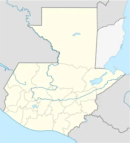
El Rodeo is a town in the Escuintla Department of Guatemala, about 35 kilometers southwest of Guatemala City. It is located at an altitude of 2,483 m (8,146 ft) above sea level on the southern slopes of an active volcano called Volcán de Fuego — Spanish for Volcano of Fire.[2]
History
The town, with a population estimated at 14,125[1] was reported to have been buried by volcanic material following the 2018 Volcán de Fuego eruption on 3 June 2018.[3][4] The town was in the early process of evacuation when the eruption happened.[5]
Other nearby towns also covered by the superheated pyroclastic flow include San Miguel Los Lotes, and Alotenango.[3][4] At least 109 people were confirmed dead,[6] and about 192 people are reported missing.[7][8]
References
- 1 2 Guatemala 2002 Census Archived 2007-06-30 at the Wayback Machine (.zip file)
- ↑ El Rodeo - Departamento de Escuintla - informacion. Pueblos 20. (in Spanish). Accessed 4 June 2014.
- 1 2 At least 33 dead in Guatemala as volcano erupts, burying an entire village. The Washington Post. Susan Hogan and Avi Selk. June 4, 2018.
- 1 2 "Guatemala volcano: Dozens die as Fuego volcano erupts". BBC News. 3 June 2018. Retrieved 3 June 2018.
- ↑ Aldea El Rodeo, el rostro de la tragedia. Luis Gonzalez, Republica. 4 June 2018. (In Spanish).
- ↑ Guatemala volcano death toll rises to 109. Associated Press. Published by Mercury News. 7 June 2018.
- ↑ More than 190 missing after Guatemala volcano eruption. CNN News. 6 June 2018.
- ↑ "Guatemala volcano: Nearly 200 missing and 75 dead". BBC News. 5 June 2018. Retrieved 5 June 2018.
This article is issued from Wikipedia. The text is licensed under Creative Commons - Attribution - Sharealike. Additional terms may apply for the media files.
