El Tambo, Cauca | |
|---|---|
Municipality and town | |
 | |
.svg.png.webp) Flag | |
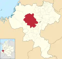
 Location of the municipality and town of El Tambo, Cauca in the Cauca Department of Colombia. | |
| Coordinates: 2°27′15″N 76°49′04″W / 2.45417°N 76.8178°W | |
| Country | |
| Department | Cauca Department |
| Population (2020 est.[1]) | |
| • Total | 48,226 |
| Time zone | UTC-5 (Colombia Standard Time) |
| Climate | Cfb |
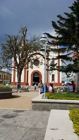
El Tambo is a municipality of Cauca Department, Colombia, located about 33 kilometres west of the departmental capital Popayán in the Andes mountain range. Within its territories is located the Munchique National Park. El Tambo is the main producer of peach palm or chontaduro in the region.
References
- ↑ "Resultados y proyecciones (2005-2020) del censo 2005". Retrieved 12 April 2020.
This article is issued from Wikipedia. The text is licensed under Creative Commons - Attribution - Sharealike. Additional terms may apply for the media files.