Lenora | |
|---|---|
_02.jpg.webp) | |
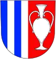
 Flag  Coat of arms | |
 Lenora Location in the Czech Republic | |
| Coordinates: 48°55′21″N 13°47′36″E / 48.92250°N 13.79333°E | |
| Country | |
| Region | South Bohemian |
| District | Prachatice |
| Founded | 1834 |
| Area | |
| • Total | 17.79 km2 (6.87 sq mi) |
| Elevation | 765 m (2,510 ft) |
| Population (2023-01-01)[1] | |
| • Total | 671 |
| • Density | 38/km2 (98/sq mi) |
| Time zone | UTC+1 (CET) |
| • Summer (DST) | UTC+2 (CEST) |
| Postal codes | 384 42, 384 51 |
| Website | www |
Lenora (German: Eleonorenhain) is a municipality and village in Prachatice District in the South Bohemian Region of the Czech Republic. It has about 700 inhabitants.
Lenora lies approximately 17 kilometres (11 mi) south-west of Prachatice, 50 km (31 mi) west of České Budějovice, and 137 km (85 mi) south of Prague.
Administrative parts
Villages of Houžná, Kaplice, Vlčí Jámy and Zátoň are administrative parts of Lenora.
History
Lenora was founded in 1834 as one of the last glassworks in Bohemian Forest.[2]
References
- ↑ "Population of Municipalities – 1 January 2023". Czech Statistical Office. 2023-05-23.
- ↑ "Strategický plán rozvoje obce Lenora 2013–2023" (PDF) (in Czech). Obec Lenora. 2013. p. 2. Retrieved 2021-08-24.
Wikimedia Commons has media related to Lenora.
This article is issued from Wikipedia. The text is licensed under Creative Commons - Attribution - Sharealike. Additional terms may apply for the media files.