Ernsthofen | |
|---|---|
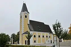 Catholic church in Ernsthofen | |
 Coat of arms | |
 Ernsthofen Location within Austria | |
| Coordinates: 48°8′N 14°29′E / 48.133°N 14.483°E | |
| Country | Austria |
| State | Lower Austria |
| District | Amstetten |
| Government | |
| • Mayor | Karl Huber |
| Area | |
| • Total | 17.79 km2 (6.87 sq mi) |
| Elevation | 264 m (866 ft) |
| Population (2018-01-01)[2] | |
| • Total | 2,230 |
| • Density | 130/km2 (320/sq mi) |
| Time zone | UTC+1 (CET) |
| • Summer (DST) | UTC+2 (CEST) |
| Postal code | 4432 |
| Area code | 07435 |
| Website | www.ernsthofen.at |
Ernsthofen is a town in the district of Amstetten in Lower Austria in Austria.
Population
| Year | Pop. | ±% |
|---|---|---|
| 1869 | 1,075 | — |
| 1880 | 1,100 | +2.3% |
| 1890 | 1,120 | +1.8% |
| 1900 | 1,202 | +7.3% |
| 1910 | 1,177 | −2.1% |
| 1923 | 1,238 | +5.2% |
| 1934 | 1,262 | +1.9% |
| 1939 | 1,279 | +1.3% |
| 1951 | 1,316 | +2.9% |
| 1961 | 1,504 | +14.3% |
| 1971 | 1,745 | +16.0% |
| 1981 | 1,825 | +4.6% |
| 1991 | 2,004 | +9.8% |
| 2001 | 2,105 | +5.0% |
| 2005 | 2,177 | +3.4% |
References
- ↑ "Dauersiedlungsraum der Gemeinden Politischen Bezirke und Bundesländer - Gebietsstand 1.1.2018". Statistics Austria. Retrieved 10 March 2019.
- ↑ Population at the beginning of the year for municipalities since 2002 (in German), Statistics Austria, January 2023, Wikidata Q27838750
This article is issued from Wikipedia. The text is licensed under Creative Commons - Attribution - Sharealike. Additional terms may apply for the media files.