| Faccombe | |
|---|---|
 Parish Church | |
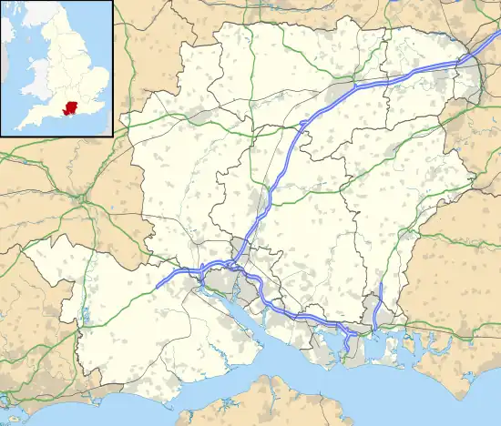
 Faccombe Location within Hampshire | |
| Population | 146 (2011 Census including Linkenholt and Netherton)[1] |
| OS grid reference | SU3907957925 |
| Civil parish |
|
| District | |
| Shire county | |
| Region | |
| Country | England |
| Sovereign state | United Kingdom |
| Post town | ANDOVER |
| Postcode district | SP11 |
| Dialling code | 01264 |
| Police | Hampshire and Isle of Wight |
| Fire | Hampshire and Isle of Wight |
| Ambulance | South Central |
| UK Parliament | |
Faccombe is a village and civil parish in Hampshire, England. The village lies on the Hampshire-Berkshire border and is situated on the North Downs. Its nearest Hampshire town is Andover, approximately 8 miles (13 km) away although Newbury in Berkshire is 2 miles (3.2 km) closer.
The village was originally called "Faccombe Upstrete" in medieval times to distinguish it from Netherton, Hampshire, a village lower in the valley.[2]

The village has an inn, The Jack Russell Inn.[3]
Landmarks
A large part of the parish is part of the Faccombe Estate which is used for shooting[4] and includes a wind turbine. The estate was formerly owned by Brigadier Timothy Landon.
The parish includes parts, although not the summits, of Combe Hill and Pilot Hill. Pilot Hill is the county top of Hampshire.
Governance
The village is part of the civil parish of Faccombe[5] and is part of the Bourne Valley ward of Test Valley District Council.[6] The district council is a Non-metropolitan district of Hampshire County Council.
References
- ↑ "Civil Parish population 2011". Neighbourhood Statistics. Office for National Statistics. Retrieved 16 December 2016.
- ↑ Fairbrother, J.R. (1990). Faccombe Netherton: Excavations of a Saxon and Medieval Manorial Complex. London: British Museum Publications. p. 40.
- ↑ "The Good Pub Guide". Penguin Random House. 2019. Retrieved 9 October 2020.
- ↑ The Field http://www.thefield.co.uk/shooting/the-50-best-sporting-estates-22216
- ↑ "Hampshire County Council's legal record of public rights of way in Hampshire" (PDF). 2008. Retrieved 23 November 2010.
- ↑ "mapit.mysociety.org Areas containing". 23 November 2010. Retrieved 23 November 2010.
