Falkenberg | |
|---|---|
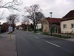 View of Dorfstraße | |
Location of Falkenberg in Lichtenberg district and Berlin 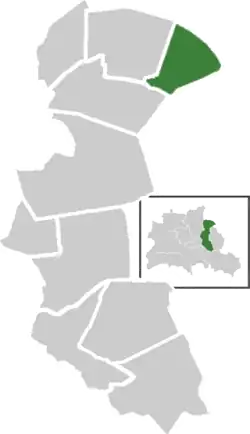 | |
 Falkenberg  Falkenberg | |
| Coordinates: 52°30′21″N 13°31′09″E / 52.50583°N 13.51917°E | |
| Country | Germany |
| State | Berlin |
| City | Berlin |
| Borough | Lichtenberg |
| Founded | 1370 |
| Area | |
| • Total | 3.06 km2 (1.18 sq mi) |
| Elevation | 60 m (200 ft) |
| Population (2020-12-31)[1] | |
| • Total | 2,189 |
| • Density | 720/km2 (1,900/sq mi) |
| Time zone | UTC+01:00 (CET) |
| • Summer (DST) | UTC+02:00 (CEST) |
| Postal codes | (nr. 1104) 13057 |
| Vehicle registration | B |
Falkenberg (German: [ˈfalkŋ̍ˌbɛʁk] ⓘ) is a German locality (Ortsteil) within the borough (Bezirk) of Lichtenberg, Berlin. Until 2001, it was part of the borough of Hohenschönhausen.
History
The settlement, inhabited by farmers from the Barnim, was first mentioned in 1370 on a document of Otto V, Duke of Bavaria. Until 1920, it was a municipality of Niederbarnim district, merged into Berlin with the "Greater Berlin Act".[2]
Geography
Situated in northeastern suburb of Berlin, Falkenberg is bounded by the Brandenburger municipality of Ahrensfelde, in Barnim district. It borders with the Berliner localities of Wartenberg, Neu-Hohenschönhausen and Marzahn (in Marzahn-Hellersdorf).
Transport
Falkenberg is not directly served by the S-Bahn, but the station of Berlin-Ahrensfelde (line S7) is not too far from the settlement. The tramway terminal stop "Falkenberg" (lines M4 and M17), located in Neu-Hohenschönhausen, also serves the locality. The Bus line 197 [3] crosses Falkenberg and links it to this two stops.
Photogallery
 Entrance to Falkenberg
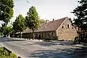 Dorfkate building
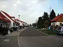 Marie Elisabeth von Humboldt Straße
References
- ↑ "Einwohnerinnen und Einwohner im Land Berlin am 31. Dezember 2020" (PDF). Amt für Statistik Berlin-Brandenburg. February 2021.
- ↑ (in German) Historical infos about Falkenberg
- ↑ (in German) Official list of BVG bus lines: 170/197
External links
![]() Media related to Falkenberg at Wikimedia Commons
Media related to Falkenberg at Wikimedia Commons
- (in German) Falkenberg page on www.berlin.de
| |