Farmers Township | |
|---|---|
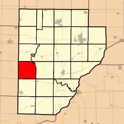 Location in Fulton County | |
 Fulton County's location in Illinois | |
| Coordinates: 40°24′47″N 90°23′52″W / 40.41306°N 90.39778°W | |
| Country | United States |
| State | Illinois |
| County | Fulton |
| Established | November 6, 1849 |
| Area | |
| • Total | 36.07 sq mi (93.4 km2) |
| • Land | 36.02 sq mi (93.3 km2) |
| • Water | 0.05 sq mi (0.1 km2) 0.14% |
| Elevation | 650 ft (198 m) |
| Population (2010) | |
| • Estimate (2016)[1] | 381 |
| • Density | 11/sq mi (4/km2) |
| Time zone | UTC-6 (CST) |
| • Summer (DST) | UTC-5 (CDT) |
| ZIP codes | 61441, 61459, 61482 |
| FIPS code | 17-057-25427 |
Farmers Township is one of twenty-six townships in Fulton County, Illinois, USA. As of the 2010 census, its population was 397 and it contained 189 housing units.[2]
Geography
According to the 2010 census, the township has a total area of 36.07 square miles (93.4 km2), of which 36.02 square miles (93.3 km2) (or 99.86%) is land and 0.05 square miles (0.13 km2) (or 0.14%) is water.[2]
Cities, towns, villages
- Table Grove (northeast half)
Cemeteries
The township contains these four cemeteries: Barker, Laurel Hill, Temple and Zoll.
Major highways
Demographics
| Census | Pop. | Note | %± |
|---|---|---|---|
| 2016 (est.) | 381 | [1] | |
| U.S. Decennial Census[3] | |||
School districts
- V I T Community Unit School District 2
Political districts
- Illinois' 17th congressional district
- State House District 94
- State Senate District 47
References
- "Farmers Township, Fulton County, Illinois". Geographic Names Information System. United States Geological Survey, United States Department of the Interior. Retrieved January 16, 2010.
- United States Census Bureau 2007 TIGER/Line Shapefiles
- United States National Atlas
- 1 2 "Population and Housing Unit Estimates". Retrieved June 9, 2017.
- 1 2 "Population, Housing Units, Area, and Density: 2010 - County -- County Subdivision and Place -- 2010 Census Summary File 1". United States Census. Archived from the original on February 12, 2020. Retrieved May 28, 2013.
- ↑ "Census of Population and Housing". Census.gov. Retrieved June 4, 2016.
External links
Places adjacent to Farmers Township, Fulton County, Illinois | |
|---|---|
Municipalities and communities of Fulton County, Illinois, United States | ||
|---|---|---|
| Cities | Map of Illinois highlighting Fulton County | |
| Town | ||
| Villages | ||
| Townships | ||
| Unincorporated communities | ||
| Ghost towns | ||
| Footnotes | ‡This populated place also has portions in an adjacent county or counties | |
This article is issued from Wikipedia. The text is licensed under Creative Commons - Attribution - Sharealike. Additional terms may apply for the media files.