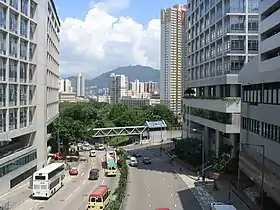
 | |
| Native name | 佛光街 (Yue Chinese) |
|---|---|
| Length | 1.45 km |
| Location | Ho Man Tin, Kowloon, Hong Kong |
| Coordinates | 22°18′44″N 114°10′55″E / 22.3121877°N 114.1819276°E |
| East | Hung Hom Road |
| West | Pui Ching Road |
| Fat Kwong Street | |||||||||||
|---|---|---|---|---|---|---|---|---|---|---|---|
| Chinese | 佛光街 | ||||||||||
| |||||||||||
Fat Kwong Street (Chinese: 佛光街) is a street in Ho Man Tin, Kowloon, Hong Kong.
History
Fat Kwong Street was originally a short street in Hung Hom. In 1967, the government proposed to build a new road link between Hung Hom and Mong Kok via Ho Man Tin, by connecting Fat Kwong Street to Pui Ching Road.[1] To facilitate this scheme, a flyover was built over Princess Margaret Road at a cost of around HK$2.1 million, which was completed in 1970.[2][3] The new road link was constructed, in part, to serve major government housing developments in the Ho Man Tin area.
The eastern part of Fat Kwong Street was closed in September 1970 due to landslides.[4] Major repairs were required, and the street did not reopen until June 1971.[5]
Description
Fat Kwong Street is approximately 1.45 km (0.90 mi) long, stretching from Princess Margaret Road to Ma Tau Wai Road. It is classified by the Hong Kong government as a district distributor road.[6]
Intersecting roads
West to east:
- Princess Margaret Road
- Pui Ching Road
- Sheung Shing Street
- Sheung Foo Street
- Sheung Lok Street
- Yan Fung Street
- Shun Yung Street
- Chatham Road North (Route 5)
- Wo Chung Street
- Ping Chi Street
- Ma Tau Wai Road
- Man Yue Street
- Man Lok Street
- Hung Hom Road
- Tai Wan Road East
References
- ↑ "Road link between Hunghom and Homantin". South China Morning Post. 28 April 1967. p. 6.
- ↑ "Project ahead of schedule". South China Morning Post. 8 January 1969. p. 6.
- ↑ "Flyover open for use". South China Morning Post. 14 February 1970. p. 6.
- ↑ "Hunghom road closed". South China Morning Post. 23 September 1970. p. 6.
- ↑ "Street repaired". South China Morning Post. 3 June 1971. p. 5.
- ↑ "Explanatory Statement of Approved Ho Man Tin Outline Zoning Plan No. S/K7/24" (PDF). Town Planning Board. p. 13.