Filotas
Φιλώτας | |
|---|---|
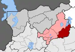
 Filotas Location within the regional unit  | |
| Coordinates: 40°38′N 21°42′E / 40.633°N 21.700°E | |
| Country | Greece |
| Administrative region | West Macedonia |
| Regional unit | Florina |
| Municipality | Amyntaio |
| • Municipal unit | 132.5 km2 (51.2 sq mi) |
| Population (2011)[1] | |
| • Municipal unit | 4,524 |
| • Municipal unit density | 34/km2 (88/sq mi) |
| Community | |
| • Population | 1,772 (2011) |
| Time zone | UTC+2 (EET) |
| • Summer (DST) | UTC+3 (EEST) |
| Vehicle registration | ΡΑ |
Filotas (Greek: Φιλώτας, before 1927: Τσαλτζιλάρ - Tsaltzilar;[2] Bulgarian: Чалджиево, Chaldzhievo) is a village and a former municipality in Florina regional unit, West Macedonia, Greece. Since the 2011 local government reform it is a municipal unit of the municipality Amyntaio.[3] The municipal unit has an area of 132.495 km2.[4] Population 4,524 (2011).
Demographics
The Greek census (1920) recorded 2,137 people in the village and in 1923 there were 2,100 inhabitants who were Muslim.[5] Following the Greek-Turkish population exchange, in 1926 within Tsaltzilar there were refugee families from East Thrace (393), Asia Minor (60) and the Caucasus (106).[5] The Greek census (1928) recorded 1893 village inhabitants.[5] There were 539 refugee families (2,188 people) in 1928.[5]
References
- 1 2 "Απογραφή Πληθυσμού - Κατοικιών 2011. ΜΟΝΙΜΟΣ Πληθυσμός" (in Greek). Hellenic Statistical Authority.
- ↑ "Name Changes of Settlements in Greece: Tsaltzilar – Filotas". Pandektis. Retrieved 30 March 2022.
- ↑ "ΦΕΚ B 1292/2010, Kallikratis reform municipalities" (in Greek). Government Gazette.
- ↑ "Population & housing census 2001 (incl. area and average elevation)" (PDF) (in Greek). National Statistical Service of Greece. Archived from the original (PDF) on 2015-09-21.
- 1 2 3 4 Pelagidis, Efstathios (1992). Η αποκατάσταση των προσφύγων στη Δυτική Μακεδονία (1923-1930) [The rehabilitation of refugees in Western Macedonia: 1923-1930] (Ph.D.). Aristotle University of Thessaloniki. p. 75. Retrieved 30 March 2022.