| Flattop Peak | |
|---|---|
 North aspect | |
| Highest point | |
| Elevation | 3,063 m (10,049 ft)[1] |
| Prominence | 182 m (597 ft)[2] |
| Parent peak | Howser Peak (3,094 m)[3] |
| Isolation | 1.17 km (0.73 mi)[3] |
| Listing | Mountains of British Columbia |
| Coordinates | 50°42′46″N 116°47′42″W / 50.71278°N 116.79500°W[4] |
| Geography | |
 Flattop Peak Location in British Columbia  Flattop Peak Flattop Peak (Canada) | |
| Country | Canada |
| Province | British Columbia |
| District | Kootenay Land District |
| Protected area | Bugaboo Provincial Park |
| Parent range | Purcell Mountains The Bugaboos[2] |
| Topo map | NTS 82K10 Howser Creek |
| Geology | |
| Age of rock | 135 Million years ago[5] |
| Type of rock | Granodiorite[5] |
| Climbing | |
| First ascent | 1930 |
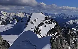
Flattop Peak is a 3,063-metre (10,049-foot) summit in British Columbia, Canada.
Description
Flattop is located in The Bugaboos, west of the Bugaboo Glacier along the southern boundary of Bugaboo Provincial Park.[6] Precipitation runoff from Flattop Peak drains east into Bugaboo Creek which is a tributary of the Columbia River; as well as west to Duncan River via East Creek. Flattop Peak is more notable for its steep rise above local terrain than for its absolute elevation as topographic relief is significant with the summit rising 1,660 meters (5,446 ft) above East Creek in 3 km (1.9 mi). The nearest higher neighbor is line parent Howser Peak, 1.21 km (0.75 mi) to the southeast.[2][3]
History
The peak's descriptive name was applied by Eaton Cromwell, who made the first ascent of the summit with Peter Kaufmann on August 10, 1930.[1][6][7] The mountain's toponym was officially adopted on June 9, 1960, by the Geographical Names Board of Canada.[4]
Climate

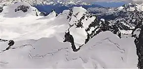
Based on the Köppen climate classification, Flattop Peak is located in a subarctic climate zone with cold, snowy winters, and mild summers.[8] Winter temperatures can drop below −20 °C with wind chill factors below −30 °C. This climate supports the Bugaboo Glacier on the peak's east slope and an unnamed glacier on the south slope.
See also
References
- 1 2 Glen W. Boles, William Lowell Putnam, Roger W. Laurilla (2006), Canadian Mountain Place Names: The Rockies and Columbia Mountains, Rocky Mountain Books, ISBN 9781894765794, p. 98.
- 1 2 3 "Flattop Peak, British Columbia". Peakbagger.com. Retrieved 2023-02-08.
- 1 2 3 "Flattop Peak - 10,072' BC". listsofjohn.com. Retrieved 2023-02-08.
- 1 2 "Flattop Peak". Geographical Names Data Base. Natural Resources Canada. Retrieved 2023-02-08.
- 1 2 Mary Caperton Morton (2017), Aerial Geology; A High-Altitude Tour of North America's Spectacular Volcanoes, Canyons, Glaciers, Lakes, Craters, and Peaks, Timber Press, ISBN 9781604698350, p. 42
- 1 2 "Flattop Peak". BC Geographical Names. Retrieved 2023-02-08.
- ↑ Eaton Cromwell (1931), In the Bugaboo Group, Americanalpineclub.org
- ↑ Peel, M. C.; Finlayson, B. L.; McMahon, T. A. (2007). "Updated world map of the Köppen−Geiger climate classification". Hydrol. Earth Syst. Sci. 11: 1633–1644. ISSN 1027-5606.
External links
- Flattop Peak: weather