Fogatuli | |
|---|---|
 Fogatuli | |
| Coordinates: 13°37′S 172°37′W / 13.617°S 172.617°W | |
| Country | Samoa |
| District | Satupa'itea |
| Electoral constituency | Salega |
| Elevation | 46 m (151 ft) |
| Population (2016) | |
| • Total | 251 |
| Time zone | UTC+13 (UTC+13:00) |
| • Summer (DST) | UTC+14 (UTC+14:00) |
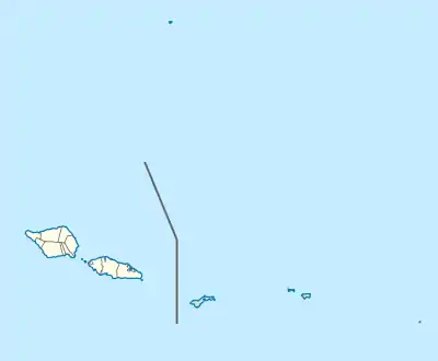
Fogatuli is a village on the island of Savai'i in Samoa. It is situated on the south coast of the island in the district of Satupa'itea and the electoral district of Salega 1.[2] The population is 251.[3]
References
- ↑ "Fogatuli". Geoview. Retrieved 21 April 2020.
- ↑ "Electoral Constituencies Act 2019" (PDF). Parliament of Samoa. 31 January 2019. Retrieved 11 September 2021.
- ↑ "Census 2016 Preliminary count" (PDF). Samoa Bureau of Statistics. 2016. Retrieved 23 August 2021.
Traditional center: Satupa'itea | ||
| Villages of Salega | 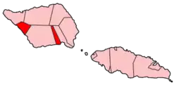 | |
| Villages of Satupa'itea | ||
| Education & Schools | ||
| Conservation & Environment | ||
| Electoral constituencies: Faipule Districts |
| |
This article is issued from Wikipedia. The text is licensed under Creative Commons - Attribution - Sharealike. Additional terms may apply for the media files.