| Fokstuguhøi | |
|---|---|
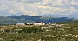
 View of Fokstuguhøi and the mountain lodge | |
| Highest point | |
| Elevation | 1,600 m (5,200 ft)[1] |
| Prominence | 43 m (141 ft)[1] |
| Parent peak | Storhøe |
| Isolation | 1.2 km (0.75 mi)[1] |
| Coordinates | 62°05′06″N 9°20′51″E / 62.08495°N 9.3476°E[2] |
| Geography | |
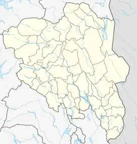
 Fokstuguhøi Location of the mountain  Fokstuguhøi Fokstuguhøi (Norway) | |
| Location | Innlandet, Norway |
| Parent range | Dovrefjell |
Fokstuguhøi is a mountain in Dovre Municipality in Innlandet county, Norway. The 1,600-metre (5,200 ft) tall mountain is located in the Dovrefjell mountains and inside the Dovre National Park, about 12 kilometres (7.5 mi) east of the village of Dombås. The mountain is surrounded by several other notable mountains including Storhøe to the east, Halvfarhøe and Gråhøe to the northeast, and Falketind and Blåberget to the north-northeast.[1]
Climate
The village of Fokstugu sits at an elevation of 973 metres (3,192 ft) above sea level. The climate around the village is borderline Subarctic climate (Dfc). Although the wet season is in summer, the driest time of year is in late spring. An extra 3 millimetres (0.12 in) in October would give it 3 times the precipitation of April. This would make Fokstugu a Subarctic climate (Dsc). The warmest month, July, has an average of only 10.2 °C (50.4 °F) making it on the border with a tundra climate (Et).
| Climate data for Fokstugu 1991-2020 (973 m / 3192 ft ASL) | |||||||||||||
|---|---|---|---|---|---|---|---|---|---|---|---|---|---|
| Month | Jan | Feb | Mar | Apr | May | Jun | Jul | Aug | Sep | Oct | Nov | Dec | Year |
| Mean daily maximum °C (°F) | −3.9 (25.0) |
−3.9 (25.0) |
−1.3 (29.7) |
3.2 (37.8) |
8.5 (47.3) |
13.1 (55.6) |
16 (61) |
14.5 (58.1) |
10 (50) |
3.8 (38.8) |
−1.1 (30.0) |
−3.4 (25.9) |
4.6 (40.4) |
| Daily mean °C (°F) | −6.5 (20.3) |
−6.8 (19.8) |
−4.8 (23.4) |
−0.6 (30.9) |
4.1 (39.4) |
8.3 (46.9) |
11.1 (52.0) |
9.9 (49.8) |
6 (43) |
0.6 (33.1) |
−3.8 (25.2) |
−6 (21) |
1.0 (33.7) |
| Mean daily minimum °C (°F) | −10.1 (13.8) |
−10.3 (13.5) |
−8.5 (16.7) |
−4.4 (24.1) |
−0.3 (31.5) |
3.6 (38.5) |
6.5 (43.7) |
5.9 (42.6) |
2.5 (36.5) |
−2.6 (27.3) |
−7 (19) |
−9.6 (14.7) |
−2.9 (26.8) |
| Source 1: seklima.met.no[3] | |||||||||||||
| Source 2: NOAA / WMO averages 91-2020 Norway [4] | |||||||||||||
| Climate data for Fokstugu 1961-1990, extremes 1965-2011 | |||||||||||||
|---|---|---|---|---|---|---|---|---|---|---|---|---|---|
| Month | Jan | Feb | Mar | Apr | May | Jun | Jul | Aug | Sep | Oct | Nov | Dec | Year |
| Record high °C (°F) | 8.8 (47.8) |
8.1 (46.6) |
8.9 (48.0) |
15.2 (59.4) |
22.0 (71.6) |
25.4 (77.7) |
26.8 (80.2) |
26.8 (80.2) |
22.5 (72.5) |
18.3 (64.9) |
11.4 (52.5) |
6.4 (43.5) |
26.8 (80.2) |
| Mean daily maximum °C (°F) | −5.5 (22.1) |
−5.0 (23.0) |
−2.3 (27.9) |
1.4 (34.5) |
8.6 (47.5) |
13.4 (56.1) |
14.8 (58.6) |
13.7 (56.7) |
8.3 (46.9) |
3.7 (38.7) |
−2.1 (28.2) |
−3.9 (25.0) |
3.8 (38.8) |
| Mean daily minimum °C (°F) | −11.7 (10.9) |
−11.5 (11.3) |
−9.3 (15.3) |
−5.7 (21.7) |
0.3 (32.5) |
4.0 (39.2) |
5.7 (42.3) |
5.2 (41.4) |
1.3 (34.3) |
−2.1 (28.2) |
−7.8 (18.0) |
−10.2 (13.6) |
−3.5 (25.7) |
| Record low °C (°F) | −32.4 (−26.3) |
−29.2 (−20.6) |
−24.8 (−12.6) |
−17.3 (0.9) |
−12.5 (9.5) |
−6.0 (21.2) |
−2.9 (26.8) |
−5.7 (21.7) |
−9.5 (14.9) |
−16.0 (3.2) |
−23.5 (−10.3) |
−29.5 (−21.1) |
−32.4 (−26.3) |
| Average precipitation mm (inches) | 28 (1.1) |
24 (0.9) |
23 (0.9) |
14 (0.6) |
26 (1.0) |
54 (2.1) |
68 (2.7) |
58 (2.3) |
42 (1.7) |
39 (1.5) |
29 (1.1) |
30 (1.2) |
435 (17.1) |
| Average precipitation days | 8.9 | 6.1 | 6.5 | 5.0 | 6.0 | 9.6 | 10.8 | 10.0 | 9.1 | 7.9 | 8.1 | 8.6 | 96.6 |
| Source: Met Norway Eklima | |||||||||||||
See also
References
- 1 2 3 4 "Fokstuguhøe". PeakVisor.com. Retrieved 15 April 2022.
- ↑ "Fokstuguhøe, Dovre" (in Norwegian). yr.no. Retrieved 15 April 2022.
- ↑ "seklima.met.no". Norwegian Meteorological Institute.
- ↑ "NOAA WMO normals Norway 1991-2020".