| Fourcorner Lake | |
|---|---|
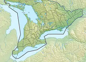
 Fourcorner Lake Location in Southern Ontario | |
| Location | Haliburton County, Ontario |
| Coordinates | 45°09′36″N 78°16′44″W / 45.160°N 78.279°W |
| Type | lake |
| Etymology | from its location at a quadripoint |
| Part of | Ottawa River drainage basin |
| Primary outflows | Fourcorner Creek |
| Basin countries | Canada |
| Max. length | 1,750 metres (5,740 ft)[1] |
| Max. width | 1,040 metres (3,410 ft)[1] |
| Surface area | 99.73 hectares (246.4 acres)[2] |
| Surface elevation | 442 metres (1,450 ft)[3] |
Fourcorner Lake (French: lac Fourcorner) is a lake in the municipality of Dysart et al, Haliburton County in Central Ontario, Canada.[4][1][2][5][6] It is partly within Algonquin Provincial Park and is in the Ottawa River drainage basin. The lake takes its name from its location at a quadripoint, the junction point of four geographic townships: Harburn at northwest, Bruton at the northeast, Harcourt at the southeast, and Dudley at the southwest.[4][1][2]
Geography
Fourcorner Lake has an area of 99.73 hectares (246.4 acres)[2] and lies at an elevation of 442 metres (1,450 ft).[3] It is 1,750 metres (5,740 ft) long and 1,050 metres (3,440 ft) wide.[1] The nearest named community is Kennaway, 8.0 kilometres (5.0 mi) to the east. The portion of the lake in geographic Bruton Township, that is the northeast portion, is the part of the lake that is within Algonquin Provincial Park.[1][2]
There two unnamed inflows: one at the southwest; and one at the north, arriving from the direction of Weepine Lake. The primary outflow, at the east end of the lake, is Fourcorner Creek. Fourcorner Creek flows via Benoir Lake, the York River and the Madawaska River to the Ottawa River.[4][1][2]
References
- 1 2 3 4 5 6 7 "Toporama (on-line map and search)". Atlas of Canada. Natural Resources Canada. Retrieved 2020-09-05.
- 1 2 3 4 5 6 "Ontario Geonames GIS (on-line map and search)". Ontario Ministry of Natural Resources and Forestry. 2014. Retrieved 2020-09-05.
- 1 2 "Google Earth". Retrieved 2020-09-05.
- 1 2 3 "Fourcorner Lake". Geographical Names Data Base. Natural Resources Canada. Retrieved 2020-09-05.
- ↑ Restructured municipalities - Ontario map #5 (Map). Restructuring Maps of Ontario. Ontario Ministry of Municipal Affairs and Housing. 2006. Archived from the original on 2020-05-11. Retrieved 2020-09-05.
- ↑ Map 5 (PDF) (Map). 1 : 700,000. Official road map of Ontario. Ministry of Transportation of Ontario. 2018-01-01. Retrieved 2020-09-05.