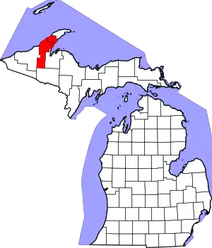
Franklin Mine, Michigan | |
|---|---|
 Franklin Mine | |
| Coordinates: 47°08′24″N 88°34′24″W / 47.14000°N 88.57333°W | |
| Country | United States |
| State | Michigan |
| County | Houghton |
| Township | Franklin and Quincy |
| Elevation | 1,184 ft (361 m) |
| Time zone | UTC-5 (Eastern (EST)) |
| • Summer (DST) | UTC-4 (EDT) |
| ZIP code(s) | 49930 (Hancock) |
| Area code | 906 |
| GNIS feature ID | 626416[1] |
Franklin Mine is a small unincorporated community in Houghton County, Michigan, United States. The area is on Quincy Hill, northeast of Hancock, and lying partially within Quincy Township and partially within Franklin Township.
Franklin Mine is located at 47°08′24″N 88°34′24″W / 47.14000°N 88.57333°W and is named after the eponymous mine.
References
External links
- Several images of the mine from American Memory at the Library of Congress
This article is issued from Wikipedia. The text is licensed under Creative Commons - Attribution - Sharealike. Additional terms may apply for the media files.
