Franklin Township | |
|---|---|
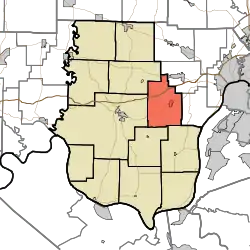 Location in Harrison County | |
| Coordinates: 38°14′23″N 86°00′20″W / 38.23972°N 86.00556°W | |
| Country | United States |
| State | Indiana |
| County | Harrison |
| Government | |
| • Type | Indiana township |
| Area | |
| • Total | 34.91 sq mi (90.4 km2) |
| • Land | 34.89 sq mi (90.4 km2) |
| • Water | 0.02 sq mi (0.05 km2) 0.06% |
| Elevation | 830 ft (253 m) |
| Population (2010) | |
| • Total | 4,104 |
| • Density | 117.6/sq mi (45.4/km2) |
| GNIS feature ID | 0453303 |
Franklin Township is one of twelve townships in Harrison County, Indiana, United States. As of the 2010 census, its population was 4,104 and it contained 1,676 housing units.[1]
Geography
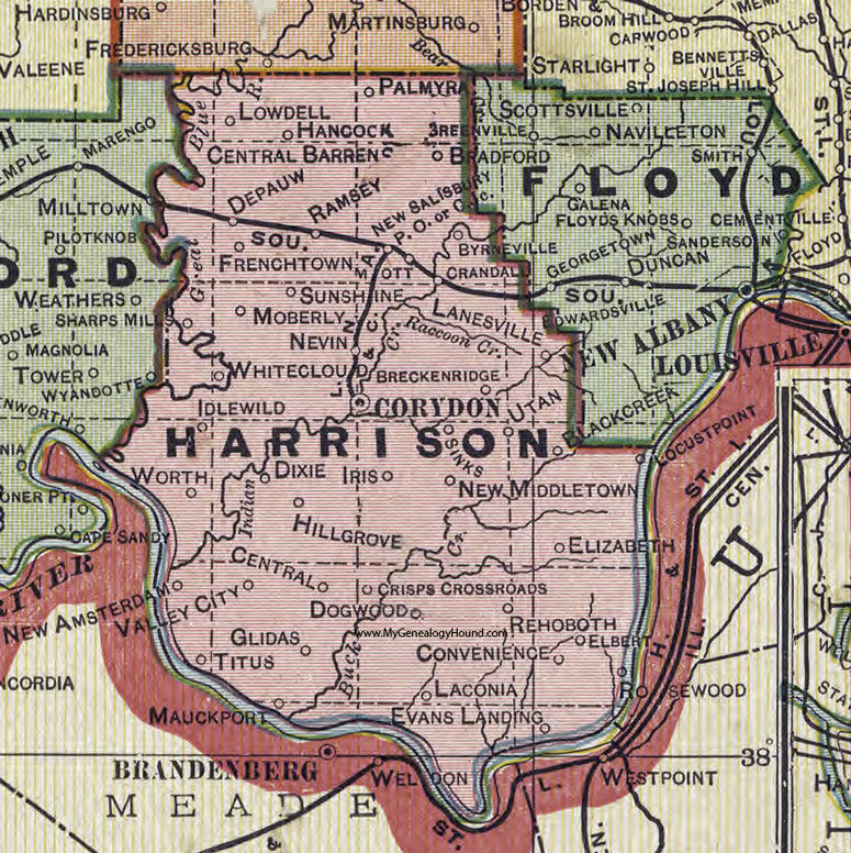
According to the 2010 census, the township has a total area of 34.91 square miles (90.4 km2), of which 34.89 square miles (90.4 km2) (or 99.94%) is land and 0.02 square miles (0.052 km2) (or 0.06%) is water.[1] The streams of Lazy Creek, Little Indian Creek, Smith Creek and Woertz Creek run through this township.
Cities and towns
Unincorporated towns
- Breckenridge
- Utan[2]
(This list is based on USGS data and may include former settlements.)
Adjacent townships
- Georgetown Township, Floyd County (northeast)
- Franklin Township, Floyd County (east)
- Posey Township (southeast)
- Webster Township (southwest)
- Harrison Township (west)
- Jackson Township (northwest)
Cemeteries
The township contains one cemetery, Lanesville.
Major highways
Airports and landing strips
- Greenridge KLA Airport
- Lanesville Skyways Airport
References
- "Franklin Township, Harrison County, Indiana". Geographic Names Information System. United States Geological Survey, United States Department of the Interior. Retrieved September 24, 2009.
- United States Census Bureau cartographic boundary files
- 1 2 "Population, Housing Units, Area, and Density: 2010 - County -- County Subdivision and Place -- 2010 Census Summary File 1". United States Census. Archived from the original on February 12, 2020. Retrieved May 10, 2013.
- ↑ https://www.mygenealogyhound.com/maps/indiana-maps/IN-Harrison-County-Indiana-1908-map.jpg
External links
Municipalities and communities of Harrison County, Indiana, United States | ||
|---|---|---|
| Towns | Map of Indiana highlighting Harrison County | |
| Townships | ||
| CDPs | ||
| Other communities | ||
| Ghost town | ||
| Footnotes | ‡This populated place also has portions in an adjacent county or counties | |
This article is issued from Wikipedia. The text is licensed under Creative Commons - Attribution - Sharealike. Additional terms may apply for the media files.