Fugong County
福贡县 | |
|---|---|
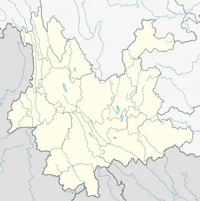
.png.webp) Location of Fugong County (pink) and Nujiang Prefecture (yellow) within Yunnan province | |
 Fugong Location of the seat in Yunnan | |
| Coordinates: 26°54′07″N 98°52′08″E / 26.902°N 98.869°E | |
| Country | China |
| Province | Yunnan |
| Autonomous prefecture | Nujiang |
| County seat | Shangpa |
| Area | |
| • Total | 2,804 km2 (1,083 sq mi) |
| Population (2020 census)[1] | |
| • Total | 114,372 |
| • Density | 41/km2 (110/sq mi) |
| Postal code | 673400 |
| Area code | 0886 |
| Website | www |
Fugong County (simplified Chinese: 福贡县; traditional Chinese: 福貢縣; pinyin: Fúgòng Xiàn) is a county located in Nujiang Lisu Autonomous Prefecture, in the west of Yunnan province, China, bordering Myanmar's Kachin State to the west.
Administrative divisions
Fugong County has 1 town, 5 townships and 1 ethnic township.[2]
- 1 town
- Shangpa (上帕镇)
- 5 townships
|
|
- 1 ethnic township
- Pihe Nu Ethnic Township (匹河怒族乡)
Climate
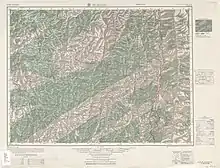
Fugong (labelled as Fu-kung (Shang-p'a) 福貢 (上怕)) (1954)
| Climate data for Fugong (1991–2020 normals, extremes 1981–2010) | |||||||||||||
|---|---|---|---|---|---|---|---|---|---|---|---|---|---|
| Month | Jan | Feb | Mar | Apr | May | Jun | Jul | Aug | Sep | Oct | Nov | Dec | Year |
| Record high °C (°F) | 27.2 (81.0) |
29.9 (85.8) |
34.3 (93.7) |
36.0 (96.8) |
37.3 (99.1) |
37.5 (99.5) |
38.3 (100.9) |
38.0 (100.4) |
37.3 (99.1) |
34.5 (94.1) |
29.9 (85.8) |
25.8 (78.4) |
38.3 (100.9) |
| Mean daily maximum °C (°F) | 19.0 (66.2) |
20.2 (68.4) |
21.0 (69.8) |
23.2 (73.8) |
26.2 (79.2) |
28.9 (84.0) |
29.4 (84.9) |
30.1 (86.2) |
28.6 (83.5) |
25.6 (78.1) |
22.6 (72.7) |
20.2 (68.4) |
24.6 (76.3) |
| Daily mean °C (°F) | 9.9 (49.8) |
12.0 (53.6) |
13.9 (57.0) |
16.6 (61.9) |
19.8 (67.6) |
22.8 (73.0) |
23.4 (74.1) |
23.5 (74.3) |
22.1 (71.8) |
18.5 (65.3) |
13.8 (56.8) |
10.2 (50.4) |
17.2 (63.0) |
| Mean daily minimum °C (°F) | 4.9 (40.8) |
7.3 (45.1) |
9.9 (49.8) |
12.8 (55.0) |
16.0 (60.8) |
19.0 (66.2) |
19.8 (67.6) |
20.0 (68.0) |
18.8 (65.8) |
14.9 (58.8) |
9.4 (48.9) |
5.2 (41.4) |
13.2 (55.7) |
| Record low °C (°F) | 0.0 (32.0) |
1.6 (34.9) |
0.0 (32.0) |
6.5 (43.7) |
10.0 (50.0) |
14.4 (57.9) |
15.5 (59.9) |
15.2 (59.4) |
11.5 (52.7) |
7.7 (45.9) |
3.3 (37.9) |
0.3 (32.5) |
0.0 (32.0) |
| Average precipitation mm (inches) | 63.4 (2.50) |
122.1 (4.81) |
215.5 (8.48) |
199.1 (7.84) |
160.9 (6.33) |
106.2 (4.18) |
151.1 (5.95) |
120.5 (4.74) |
100.7 (3.96) |
119.0 (4.69) |
40.6 (1.60) |
18.5 (0.73) |
1,417.6 (55.81) |
| Average precipitation days (≥ 0.1 mm) | 8.0 | 11.7 | 18.0 | 20.8 | 20.0 | 20.8 | 23.6 | 21.8 | 19.8 | 14.9 | 6.7 | 3.2 | 189.3 |
| Average snowy days | 0.2 | 0 | 0.1 | 0 | 0 | 0 | 0 | 0 | 0 | 0 | 0 | 0 | 0.3 |
| Average relative humidity (%) | 73 | 72 | 76 | 79 | 80 | 82 | 83 | 82 | 83 | 82 | 79 | 75 | 79 |
| Mean monthly sunshine hours | 145.5 | 121.0 | 111.6 | 102.5 | 96.5 | 85.1 | 85.0 | 101.4 | 85.5 | 116.9 | 147.2 | 160.2 | 1,358.4 |
| Percent possible sunshine | 44 | 38 | 30 | 26 | 23 | 21 | 20 | 25 | 23 | 33 | 46 | 49 | 32 |
| Source: China Meteorological Administration[3][4] | |||||||||||||
See also
- Three Parallel Rivers of Yunnan Protected Areas - Unesco World Heritage Site
References
- ↑ "怒江州第七次全国人口普查主要数据公报" (in Chinese). Government of Nujiang Prefecture. 2021-05-28.
- ↑ "国家统计局" (in Chinese). National Bureau of Statistics of the People's Republic of China. Retrieved 2021-12-07.
- ↑ 中国气象数据网 – WeatherBk Data (in Simplified Chinese). China Meteorological Administration. Retrieved 20 September 2023.
- ↑ 中国气象数据网 (in Simplified Chinese). China Meteorological Administration. Retrieved 20 September 2023.
External links
This article is issued from Wikipedia. The text is licensed under Creative Commons - Attribution - Sharealike. Additional terms may apply for the media files.