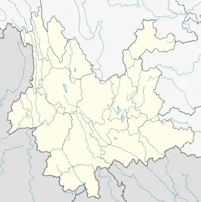
Longchuan County
陇川县 | |
|---|---|
| Other transcription(s) | |
| • Pinyin | Lǒngchuān Xiàn |
| • Tai Nuea | ᥔᥦᥢᥱ ᥛᥫᥒᥰ ᥝᥢᥰ |
| • Jingpho | Nshon Ginwang |
 Longchuan County Location within China  Longchuan County Longchuan County (China) | |
| Coordinates: 24°15′00″N 97°50′00″E / 24.25°N 97.8333°E | |
| Country | China |
| Province | Yunnan |
| Autonomous prefecture | Dehong |
| County seat | Zhangfeng |
| Area | |
| • Total | 1,931 km2 (746 sq mi) |
| Population (2020 census)[1] | |
| • Total | 181,364 |
| • Density | 94/km2 (240/sq mi) |
| Time zone | UTC+8 (CST) |
| Postal code | 678700 |
| Area code | 0692 |
| Website | www |
Longchuan County (simplified Chinese: 陇川县; traditional Chinese: 隴川縣; pinyin: Lǒngchuān Xiàn; Tai Nuea: ᥔᥦᥢᥱ ᥛᥫᥒᥰ ᥝᥢᥰ; Jingpho: Nshon Ginwang; Thai: เมืองวัน) is a county located in Dehong Prefecture, Yunnan province, southwestern China.
Administration
The county seat is in Zhangfeng Town (章凤镇).
Three other townships have been upgraded to town (镇, zhen) status: Longba (陇把), Chengzi (城子), Jinghan (景罕)
At present, Longchuan County has 4 towns, 4 townships and 1 ethnic township.[2]
- 4 towns
|
|
- 4 townships
|
|
- 1 ethnic township
- Husa Achang Ethnic Township (户撒阿昌族乡)
Culture
Many citizens of Dehong Prefecture belong to the Jingpo-nation ethnic group, an official minority in the People's Republic of China. They are one and the same as the people of Kachin State, the adjacent part of Myanmar, and ethno-linguistic ties are strong.
Climate
| Climate data for Longchuan (1991–2020 normals, extremes 1981–2010) | |||||||||||||
|---|---|---|---|---|---|---|---|---|---|---|---|---|---|
| Month | Jan | Feb | Mar | Apr | May | Jun | Jul | Aug | Sep | Oct | Nov | Dec | Year |
| Record high °C (°F) | 27.6 (81.7) |
30.1 (86.2) |
33.4 (92.1) |
34.4 (93.9) |
34.9 (94.8) |
34.4 (93.9) |
34.2 (93.6) |
34.2 (93.6) |
33.7 (92.7) |
33.6 (92.5) |
29.6 (85.3) |
27.7 (81.9) |
34.9 (94.8) |
| Mean daily maximum °C (°F) | 22.2 (72.0) |
24.4 (75.9) |
27.6 (81.7) |
29.5 (85.1) |
29.2 (84.6) |
28.5 (83.3) |
27.7 (81.9) |
28.6 (83.5) |
28.7 (83.7) |
27.4 (81.3) |
25.1 (77.2) |
22.5 (72.5) |
26.8 (80.2) |
| Daily mean °C (°F) | 11.8 (53.2) |
14.0 (57.2) |
17.7 (63.9) |
20.8 (69.4) |
22.6 (72.7) |
23.6 (74.5) |
23.5 (74.3) |
23.7 (74.7) |
22.9 (73.2) |
20.6 (69.1) |
16.5 (61.7) |
12.9 (55.2) |
19.2 (66.6) |
| Mean daily minimum °C (°F) | 4.7 (40.5) |
6.4 (43.5) |
10.1 (50.2) |
14.3 (57.7) |
18.0 (64.4) |
20.7 (69.3) |
21.1 (70.0) |
21.0 (69.8) |
19.7 (67.5) |
16.7 (62.1) |
11.1 (52.0) |
6.7 (44.1) |
14.2 (57.6) |
| Record low °C (°F) | −2.9 (26.8) |
−1.2 (29.8) |
1.4 (34.5) |
6.4 (43.5) |
10.1 (50.2) |
15.7 (60.3) |
15.8 (60.4) |
16.7 (62.1) |
12.2 (54.0) |
6.5 (43.7) |
2.0 (35.6) |
−0.8 (30.6) |
−2.9 (26.8) |
| Average precipitation mm (inches) | 18.4 (0.72) |
15.0 (0.59) |
20.1 (0.79) |
63.0 (2.48) |
164.0 (6.46) |
285.1 (11.22) |
333.3 (13.12) |
240.7 (9.48) |
160.4 (6.31) |
133.1 (5.24) |
43.6 (1.72) |
10.5 (0.41) |
1,487.2 (58.54) |
| Average precipitation days (≥ 0.1 mm) | 2.8 | 3.8 | 5.2 | 9.9 | 17.8 | 25.1 | 26.7 | 24.0 | 19.4 | 14.2 | 5.4 | 2.4 | 156.7 |
| Average relative humidity (%) | 77 | 71 | 66 | 69 | 77 | 85 | 88 | 87 | 86 | 85 | 82 | 82 | 80 |
| Mean monthly sunshine hours | 234.1 | 230.4 | 256.3 | 242.7 | 203.5 | 123.7 | 93.9 | 131.6 | 143.4 | 166.1 | 206.0 | 219.0 | 2,250.7 |
| Percent possible sunshine | 70 | 72 | 68 | 63 | 49 | 30 | 23 | 33 | 39 | 47 | 63 | 67 | 52 |
| Source: China Meteorological Administration[3][4] | |||||||||||||
References
- ↑ "德宏州第七次全国人口普查主要数据公报" (in Chinese). Government of Dehong Prefecture. 2021-06-11.
- ↑ "国家统计局" (in Chinese). National Bureau of Statistics of the People's Republic of China. Retrieved 2021-12-07.
- ↑ 中国气象数据网 – WeatherBk Data (in Simplified Chinese). China Meteorological Administration. Retrieved 20 September 2023.
- ↑ 中国气象数据网 (in Simplified Chinese). China Meteorological Administration. Retrieved 20 September 2023.
External links
This article is issued from Wikipedia. The text is licensed under Creative Commons - Attribution - Sharealike. Additional terms may apply for the media files.