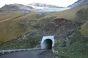
 The western entrance of the tunnel | |
| Overview | |
|---|---|
| Coordinates | North West: 62°06′22″N 7°25′41″W / 62.106031°N 7.428131°W South East: 62°05′40″N 7°24′21″W / 62.094444°N 7.405772°W |
| Technical | |
| Length | 1400m |
The Gásadalur Tunnel, Gásadalstunnilin, is a 1.4 kilometre long,[1] single-lane tunnel in the west of the Faroe Islands, on the island of Vágar. It connects the villages of Bøur in the east with Gásadalur in the west, which are separated by the Knúkarnir mountain.[2]
The tunnel was initially open to pedestrians in 2003 but it was not until 2006[3] that it was officially open and available to vehicles.
See also
- List of tunnels of the Faroe Islands
 Geographic data related to Gásadalstunnilin at OpenStreetMap
References
- ↑ "The World's longest Tunnel Page: Tunnels in Faerö Islands". www.lotsberg.net.
- ↑ "OpenStreetMap | Node: Knúkarnir (302104878)". OpenStreetMap.
- ↑ "10 facts you didn't know about the Faroe Islands". blog.tripwolf.com.
This article is issued from Wikipedia. The text is licensed under Creative Commons - Attribution - Sharealike. Additional terms may apply for the media files.