Gandhigram | |
|---|---|
Neighbourhood | |
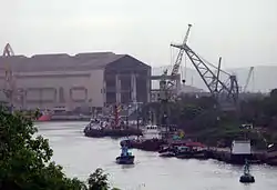 Hindustan Shipyard at Gandhigram | |
 Gandhigram Location in Visakhapatnam | |
| Coordinates: 17°40′53″N 83°15′33″E / 17.681492°N 83.259135°E | |
| Country | |
| State | Andhra Pradesh |
| District | Visakhapatnam |
| Government | |
| • Body | Greater Visakhapatnam Municipal Corporation |
| Languages | |
| • Official | Telugu |
| Time zone | UTC+5:30 (IST) |
| PIN | 530 005 |
| Vehicle registration | AP-31 |
Gandhigram is a neighborhood city of Visakhapatnam , India. The area, which falls under the local administrative limits of Greater Visakhapatnam Municipal Corporation, is one of the naval and civilian locality in the City.[1] Gandhigram is located between Scindia and Malkapuram and this area is well connected with city buses there are naval hospital and naval schools are situated hear .[2]
References
- ↑ "location". maps of india. 28 March 2013. Retrieved 23 September 2017.
- ↑ "about". the hindu. 12 April 2016. Retrieved 21 September 2017.
This article is issued from Wikipedia. The text is licensed under Creative Commons - Attribution - Sharealike. Additional terms may apply for the media files.