| Gartempe | |
|---|---|
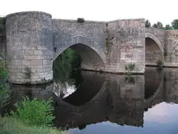 The Gartempe bridge in Saint-Savin | |
 | |
| Location | |
| Country | France |
| Regions | Centre-Val de Loire and Nouvelle-Aquitaine |
| Physical characteristics | |
| Source | |
| • location | Limousin |
| Mouth | |
• location | Creuse |
• coordinates | 46°47′3″N 0°49′48″E / 46.78417°N 0.83000°E |
| Length | 205 km (127 mi) |
| Basin size | 3,950 km2 (1,530 sq mi) |
| Basin features | |
| Progression | Creuse→ Vienne→ Loire→ Atlantic Ocean |
The Gartempe (French pronunciation: [ɡaʁtɑ̃p]) is a French river, 205 kilometres (127 mi) long.[1] It is a left tributary of the Creuse, which it joins in La Roche-Posay. Its source is in the municipality of Peyrabout.
Among its tributaries are the Anglin, the Brame, the Semme and the Ardour.
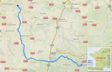
The Gartempe flows generally northwest through the following departments and towns:
References
Wikimedia Commons has media related to Gartempe river.
This article is issued from Wikipedia. The text is licensed under Creative Commons - Attribution - Sharealike. Additional terms may apply for the media files.