General Sánchez Cerro | |
|---|---|
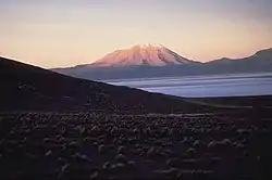 Ubinas volcano in the General Sánchez Cerro Province | |
 Flag  Coat of arms | |
 Location of General Sánchez Cerro in the Moquegua Region | |
| Country | Peru |
| Region | Moquegua |
| Capital | Omate |
| Government | |
| • Mayor | Mauricio Jose Nina Juarez (2007) |
| Area | |
| • Total | 5,681.71 km2 (2,193.72 sq mi) |
| Elevation | 2,166 m (7,106 ft) |
| Population | |
| • Total | 25,809 |
| • Density | 4.5/km2 (12/sq mi) |
| UBIGEO | 1802 |
The General Sánchez Cerro Province is the smallest of three provinces in the Moquegua Region of Peru.[1][2] The capital of the province is Omate. The province was named after the former Peruvian army officer and president Luis Miguel Sánchez Cerro.
Boundaries
- North: Arequipa Region
- East: Puno Region
- South: Mariscal Nieto Province
- West: Arequipa Region
Geography
One of the highest peaks of the province is the Ubinas volcano. Other mountains are listed below:[3]
- Allqamarini
- Chuqipata
- Churi Wiqu
- Ch'allapata
- Ch'iyar Jaqhi
- Ch'unch'uni
- Hatun P'ukru
- Janq'u Saxa
- Jaqhi Jaqhini
- Jat'u K'achi
- Jichu Qullu
- Larama Quta
- Llallawa
- Llaqtayuq
- Kunturini
- Millu
- Minasniyuq
- Misiwa
- Pachakutiq (Arequipa-M.)
- Pachakutiq (Moquegua)
- Parwayuni
- Pirwa Tira
- Pirwani
- Puka Apachita
- Puka Saya
- Pukara
- Paqu Paquni
- Pura Purani
- P'aqu Urqu
- Qayqu
- Qillqata
- Qullpani
- Qhuyu Parwayuni
- Q'ulini
- Q'uwa Laki
- Rukutuni
- Suri Wasi
- Takuni
- Taruj Sallani
- Uturunqani (Ichuña)
- Uturunqani (Moquegua-Puno)
- Wallqani
- Wankarani
- Wari Pukara
- Wayllani
- Wila Qullu
- Wila Sirka
- Wila Wilani
- Wilani
- Wit'uni
- Yana Qaqa
- Yawri Salla
- Yuraq Urqu
Political division
The province is divided into eleven districts, which are:
Ethnic groups
The province is inhabited by indigenous citizens of Aymara and Quechua descent. Spanish, however, is the language which the majority of the population (60.36%) learnt to speak in childhood, 37.45% of the residents started speaking using the Quechua language and 1.98% using Aymara (2007 Peru Census).[4]
See also
References
- ↑ (in Spanish) INEI
- ↑ (in Spanish) IPAM
- ↑ escale.minedu.gob.pe - UGEL maps of the provinces of General Sánchez Cerro Province (Tacna Region), Mariscal Nieto Province (Tacna Region) and Puno Province 1 (Puno Region)
- ↑ inei.gob.pe Archived January 27, 2013, at the Wayback Machine INEI, Peru, Censos Nacionales 2007
| |
|---|---|
This article is issued from Wikipedia. The text is licensed under Creative Commons - Attribution - Sharealike. Additional terms may apply for the media files.