Geras | |
|---|---|
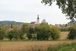 View of Geras | |
 Coat of arms | |
 Geras Location within Austria | |
| Coordinates: 48°48′N 15°40′E / 48.800°N 15.667°E | |
| Country | Austria |
| State | Lower Austria |
| District | Horn |
| Government | |
| • Mayor | Johann Glück |
| Area | |
| • Total | 67.66 km2 (26.12 sq mi) |
| Elevation | 460 m (1,510 ft) |
| Population (2018-01-01)[2] | |
| • Total | 1,325 |
| • Density | 20/km2 (51/sq mi) |
| Time zone | UTC+1 (CET) |
| • Summer (DST) | UTC+2 (CEST) |
| Postal code | 2093, 3752, 3753 |
| Area code | 02912 |
| Website | www.geras.gv.at |
Geras is a town in Lower Austria in the district of Horn in Austria.
Population
| Year | Pop. | ±% |
|---|---|---|
| 1869 | 2,442 | — |
| 1880 | 2,420 | −0.9% |
| 1890 | 2,488 | +2.8% |
| 1900 | 2,540 | +2.1% |
| 1910 | 2,622 | +3.2% |
| 1923 | 2,559 | −2.4% |
| 1934 | 2,494 | −2.5% |
| 1939 | 2,399 | −3.8% |
| 1951 | 2,344 | −2.3% |
| 1961 | 1,992 | −15.0% |
| 1971 | 1,808 | −9.2% |
| 1981 | 1,637 | −9.5% |
| 1991 | 1,531 | −6.5% |
| 2001 | 1,433 | −6.4% |
| 2011 | 1,370 | −4.4% |
References
- ↑ "Dauersiedlungsraum der Gemeinden Politischen Bezirke und Bundesländer - Gebietsstand 1.1.2018". Statistics Austria. Retrieved 10 March 2019.
- ↑ "Einwohnerzahl 1.1.2018 nach Gemeinden mit Status, Gebietsstand 1.1.2018". Statistics Austria. Retrieved 9 March 2019.
Wikimedia Commons has media related to Geras, Lower Austria.
This article is issued from Wikipedia. The text is licensed under Creative Commons - Attribution - Sharealike. Additional terms may apply for the media files.