Ginnheim | |
|---|---|
 Coat of arms | |
Location of Ginnheim (red) and the Ortsbezirk Mitte-Nord (light red) within Frankfurt am Main 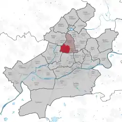 | |
 Ginnheim  Ginnheim | |
| Coordinates: 50°08′25″N 08°38′50″E / 50.14028°N 8.64722°E | |
| Country | Germany |
| State | Hesse |
| Admin. region | Darmstadt |
| District | Urban district |
| City | Frankfurt am Main |
| Area | |
| • Total | 2.701 km2 (1.043 sq mi) |
| Population (2020-12-31)[1] | |
| • Total | 16,826 |
| • Density | 6,200/km2 (16,000/sq mi) |
| Time zone | UTC+01:00 (CET) |
| • Summer (DST) | UTC+02:00 (CEST) |
| Postal codes | 60431 |
| Dialling codes | 069 |
| Vehicle registration | F |
| Website | www.ginnheim.de |
Ginnheim is a quarter of Frankfurt am Main, Germany. It is part of the Ortsbezirk Mitte-Nord.

Elevated route for motorway and U1-subway at Rosa-Luxemburg-Straße, facing Ginnheim; Europaturm tower on the left.
References
- ↑ "Frankfurt Statsitik Aktuell 07/2021". Stadt Frankfurt am Main. July 2021.

This article is issued from Wikipedia. The text is licensed under Creative Commons - Attribution - Sharealike. Additional terms may apply for the media files.