Glasterlaw | |
|---|---|
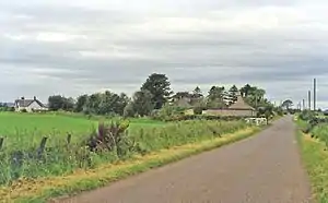 The site of the station in 1997 | |
| General information | |
| Location | Glasterlaw, Angus Scotland |
| Coordinates | 56°39′04″N 2°39′33″W / 56.651°N 2.6592°W |
| Grid reference | NO596512 |
| Platforms | 2 |
| Other information | |
| Status | Disused |
| History | |
| Original company | Aberdeen Railway |
| Pre-grouping | Aberdeen Railway Caledonian Railway |
| Post-grouping | London, Midland and Scottish Railway |
| Key dates | |
| 1 February 1848 | Opened |
| 2 April 1951 | Closed to passengers |
| 11 June 1956 | Closed completely |
Glasterlaw railway station served the area of Glasterlaw, Angus, Scotland from 1848 to 1956 on the Aberdeen Railway.
History
The station opened on 1 February 1848 by the Aberdeen Railway. The goods yard was to the north. The station closed to passengers on 2 April 1951[1] and to goods traffic on 11 June 1956.[2]
References
- ↑ "Glasterlaw Station". Canmore. Retrieved 20 July 2018.
- ↑ "Glasterlaw station (site/remains), 1997". Geograph. Retrieved 20 July 2018.
External links
| Preceding station | Disused railways | Following station | ||
|---|---|---|---|---|
| Farnell Road Line and station closed |
Aberdeen Railway | Guthrie Line and station closed | ||
| Leysmill Line and station closed |
Arbroath and Forfar Railway | Guthrie Line and station closed |
This article is issued from Wikipedia. The text is licensed under Creative Commons - Attribution - Sharealike. Additional terms may apply for the media files.