Glendale, Kansas | |
|---|---|
 Location within Saline County and Kansas | |
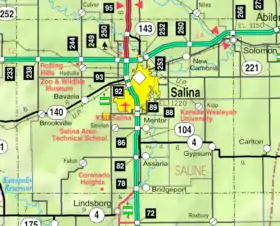 KDOT map of Saline County (legend) | |
| Coordinates: 38°53′54″N 97°52′30.1″W / 38.89833°N 97.875028°W[1] | |
| Country | United States |
| State | Kansas |
| County | Saline |
| Elevation | 1,388 ft (423 m) |
| Time zone | UTC-6 (CST) |
| • Summer (DST) | UTC-5 (CDT) |
| ZIP code | 67425 |
| Area code | 785 |
| FIPS code | 20-26450 [1] |
| GNIS ID | 476626 [1] |
Glendale is an unincorporated community in Saline County, Kansas, United States.[1] It is located about 15 miles (24 km) northwest of Salina, along the Kansas and Oklahoma Railroad line, at the intersection of N Brookville Rd and W Watkins Rd about 1.0 mile (1.6 km) north of I-70 interstate. It is the only community within the boundaries of the Glendale Township. There are no businesses or services located at Glendale.
Demographics
As a part of Saline County, Glendale is a part of the Salina micropolitan area.[2]
Education
The community is served by Twin Valley USD 240 public school district.
References
- 1 2 3 4 5 "Glendale, Kansas", Geographic Names Information System, United States Geological Survey, United States Department of the Interior
- ↑ Nussle, Jim (November 20, 2008). "Micropolitan Statistical Areas" (PDF). List 1-9. Office of Management and Budget, Executive Office of the President. p. 97. Retrieved April 2, 2010.
Further reading
External links
Municipalities and communities of Saline County, Kansas, United States | ||
|---|---|---|
| Cities | 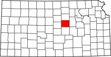 Map of Kansas highlighting Saline County | |
| Unincorporated communities | ||
| Townships |
| |
| Footnotes | †This community is designated a Census-Designated Place (CDP) by the United States Census Bureau. ‡This community also has portions in an adjacent county or counties. | |
This article is issued from Wikipedia. The text is licensed under Creative Commons - Attribution - Sharealike. Additional terms may apply for the media files.