Glyn Abbey | |
|---|---|
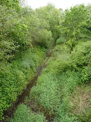
 The trackbed of the old railway and Kymer's Canal. | |
| General information | |
| Location | Kidwelly, Carmarthenshire Wales |
| Coordinates | 51°44′34″N 4°15′03″W / 51.7428°N 4.2509°W |
| Grid reference | SN446073 |
| Platforms | 1 |
| Other information | |
| Status | Disused |
| History | |
| Original company | Burry Port and Gwendraeth Valley Railway |
| Pre-grouping | Great Western Railway |
| Post-grouping | Great Western Railway |
| Key dates | |
| 2 August 1909[1] | Station opened |
| November 1910 | Renamed Glyn Abbey |
| 3 May 1943[2] | Station closed |
Glyn Abbey railway station was opened in 1909[2] as Pontnewydd Halt[3] It continued to serve the inhabitants of the Pont-newydd area and hinterland between 1909 and 1943; it was one of several basic halts opened on the Burry Port and Gwendraeth Valley Railway in Carmarthenshire, Wales.
History

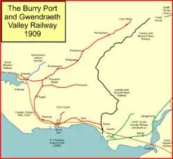
The station was opened as Pontnewydd on 1 February 1909 by the Burry Port and Gwendraeth Valley Railway on the Kidwelly and Burry Port section of the line and was closed by the Great Western Railway in 1943 with the last passenger train on the line running nearly ten years later on Saturday 19 September 1953.[1] It was on the Burry Port and Gwendraeth Valley Railway with Trimsaran Road located to the south and Pontyates to the north of the East Kidwelly Junction.[1]
The station was renamed as Glyn Abbey in 1910.[2] The name change may have been to avoid confusion with Upper Pontnewydd at Cwmbran and Lower Pontnewydd at Torfaen. Glyn Abbey was a country house located nearby and linked directly to Pont-newydd by a footpath.[4]
A rural area which once had a public house, the Smiths' Arms, at the nearby Pont-newydd hamlet. The Bryn Forest Inn was also close by on the road to Tre-Goch hamlet.[5] Many old coal pits were once active in the area.[4]
The railway was originally a freight only line,[6] built on the route of an old canal and prone to flooding, but stations were established due to pressure from the public. The freight service continued for coal traffic until 1996 by which time the last of the local collieries had closed down.[7][8]
Infrastructure
The station had one wooden platform on the western side of this single track line with a small wooden shelter. The station had no public sidings; a road overbridge still stands to the north.[3][9][4]
Remnants
The section south of Pinged, between Burry Port and Craiglon Bridge Halt is now a footpath and cycleway, however this section remains abandoned although a footpath has been established in the area.
Routes
| Preceding station | Historical railways | Following station | ||
|---|---|---|---|---|
| Trimsaran Road Line and station closed |
Burry Port and Gwendraeth Valley Railway Great Western Railway |
Pontyates Line and station Closed | ||
See also
References
- 1 2 3 Butt, R.V.J. (1995). The Directory of Railway Stations. Yeovil: Patrick Stephens Ltd. p. 188. ISBN 1-85260-508-1. R508.
- 1 2 3 Butt, R.V.J. (1995). The Directory of Railway Stations. Yeovil: Patrick Stephens Ltd. p. 105. ISBN 1-85260-508-1. R508.
- 1 2 Carmarthenshire, LIII.8, Revised: 1913, Published: 1915
- 1 2 3 SN40SW - A, Surveyed / Revised: Pre-1930 to 1963, Published: 1964
- ↑ OS 1:1m to 1:63k 1920-1940's
- ↑ 1:1 million - 1:1 10K, 1900s
- ↑ Colonel Stephens Society
- ↑ SN40SW - A, Surveyed / Revised:Pre-1930 to 1963, Published:1964
- ↑ Ordnance Survey, 1:25,000 maps of Great Britain - 1937-1961