Godveerdegem | |
|---|---|
Village | |
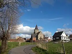 Saint Paul's Conversion Church of Godveerdegem (2008) | |
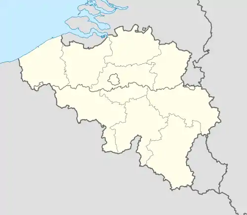 Godveerdegem Location in Belgium | |
| Coordinates: 50°52′N 3°49′E / 50.867°N 3.817°E | |
| Country | |
| Region | Flemish Region |
| Province | East Flanders |
| Municipality | Zottegem |
| Area | |
| • Total | 3.34 km2 (1.29 sq mi) |
| Population (2021)[1] | |
| • Total | 1,317 |
| • Density | 390/km2 (1,000/sq mi) |
| Time zone | CET |
Godveerdegem is a village belonging to the municipality of Zottegem. It is located on the Molenbeek-Ter Erpenbeek in the Denderstreek and in the Flemish Ardennes, the hilly southern part of the province of East Flanders, Belgium.
The Molenbeek-Ter Erpenbeek has its source in Godveerdegem.[2]
History
The village was first mentioned in 1776 as Gotferthengem. It was first a heerlijkheid, and was later elevated to a barony.[3]
The Saint Paul's Conversion Church of Godveerdegem dates back to at least 1176. In 1962, the Belgian Government classified it as an important cultural asset.[4]
In 1970, the municipality merged into Zottegem.[5] The former municipality covered an area of 3.27 square kilometres (1.26 sq mi).[3]
References
- 1 2 "Bevolking per statistische sector - Sector 41081E". Statistics Belgium. Retrieved 5 May 2022.
- ↑ "Watermolens, kapelletjes en den Dotter". Walking in Belgium (in Dutch). Retrieved 22 October 2020.
- 1 2 "Godveerdegem". Agentschap Onroerend Erfgoed (in Dutch). Retrieved 22 October 2020.
- ↑ Koenraad DE WOLF, Architectuurgids Zuid-Oost-Vlaanderen. Romaanse Bouwkunst (1000-1225), 1996, pp. 17, 70-71.
- ↑ "Zottegem". Agentschap Onroerend Erfgoed (in Dutch). Retrieved 22 October 2020.
External links
 Media related to Godveerdegem at Wikimedia Commons
Belgian municipality Zottegem | |
|---|---|
| Deelgemeentes | |
| Buildings and sights | |
| |
This article is issued from Wikipedia. The text is licensed under Creative Commons - Attribution - Sharealike. Additional terms may apply for the media files.