Grand Ridge, Florida | |
|---|---|
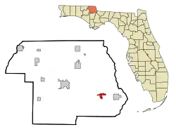
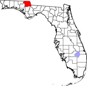
 Location in Jackson County and the state of Florida | |
| Coordinates: 30°42′43″N 85°1′5″W / 30.71194°N 85.01806°W | |
| Country | |
| State | |
| County | Jackson |
| Area | |
| • Total | 4.52 sq mi (11.71 km2) |
| • Land | 4.35 sq mi (11.26 km2) |
| • Water | 0.17 sq mi (0.44 km2) |
| Elevation | 128 ft (39 m) |
| Population (2020) | |
| • Total | 882 |
| • Density | 202.81/sq mi (78.30/km2) |
| Time zone | UTC-6 (Central (CST)) |
| • Summer (DST) | UTC-5 (CDT) |
| ZIP code | 32442 |
| Area code | 850 |
| FIPS code | 12-27175[2] |
| GNIS feature ID | 0283275[3] |
Grand Ridge is a town in Jackson County, Florida, United States. The population was 892 at the 2010 census,[4] up from 792 at the 2000 census.
History
John T. Porter owned the West Florida Echo, a newspaper in Grande Ridge. He was a Republican[5] and it is reported as the only Republican newspaper in west Florida at the start of the 20th century. His son Ebenezer F. Porter became a state legislator in Kansas.[6]
Geography
Grand Ridge is located in southeastern Jackson County at 30°42′43″N 85°1′5″W / 30.71194°N 85.01806°W (30.711977, –85.018091).[7] U.S. Route 90 travels through the northern side of the town, leading east 11 miles (18 km) to Chattahoochee and northwest 13 miles (21 km) to Marianna, the county seat. Florida State Road 69 runs through the center of town as Porter Avenue, leading north 10 miles (16 km) to Two Egg and south 4 miles (6 km) to Interstate 10 at Exit 152.
According to the United States Census Bureau, Grand Ridge has a total area of 4.42 square miles (11.4 km2), of which 4.25 square miles (11.0 km2) are land and 0.17 square miles (0.44 km2), or 3.85%, are water.[8]
Demographics
| Census | Pop. | Note | %± |
|---|---|---|---|
| 1960 | 415 | — | |
| 1970 | 512 | 23.4% | |
| 1980 | 591 | 15.4% | |
| 1990 | 536 | −9.3% | |
| 2000 | 792 | 47.8% | |
| 2010 | 892 | 12.6% | |
| 2020 | 882 | −1.1% | |
| U.S. Decennial Census[9] | |||
2020 census
| Race | Number | Percentage |
|---|---|---|
| White (NH) | 725 | 82.2% |
| Black or African American (NH) | 101 | 11.45% |
| Native American or Alaska Native (NH) | 3 | 0.34% |
| Asian (NH) | 3 | 0.34% |
| Mixed/Multi-Racial (NH) | 35 | 3.97% |
| Hispanic or Latino | 15 | 1.7% |
| Total | 882 |
As of the 2020 United States census, there were 882 people, 386 households, and 263 families residing in the town.
2000 census
As of the census[2] of 2000, there were 792 people, 309 households, and 232 families residing in the town. The population density was 364.8 inhabitants per square mile (140.9/km2). There were 344 housing units at an average density of 158.4 per square mile (61.2/km2). The racial makeup of the town was 93.56% White, 2.53% African American, 2.27% Native American, 0.13% Pacific Islander, 0.76% from other races, and 0.76% from two or more races. Hispanic or Latino of any race were 1.26% of the population.
There were 309 households, out of which 35.9% had children under the age of 18 living with them, 59.9% were married couples living together, 13.6% had a female householder with no husband present, and 24.6% were non-families. 22.0% of all households were made up of individuals, and 8.1% had someone living alone who was 65 years of age or older. The average household size was 2.56 and the average family size was 2.95.
In the town, the population was spread out, with 26.3% under the age of 18, 7.6% from 18 to 24, 31.2% from 25 to 44, 23.5% from 45 to 64, and 11.5% who were 65 years of age or older. The median age was 36 years. For every 100 females, there were 91.8 males. For every 100 females age 18 and over, there were 85.4 males.
The median income for a household in the town was $31,083, and the median income for a family was $36,875. Males had a median income of $24,722 versus $20,125 for females. The per capita income for the town was $14,556. About 9.6% of families and 16.5% of the population were below the poverty line, including 26.5% of those under age 18 and 11.2% of those age 65 or over.
References
- ↑ "2020 U.S. Gazetteer Files". United States Census Bureau. Retrieved October 31, 2021.
- 1 2 "U.S. Census website". United States Census Bureau. Retrieved January 31, 2008.
- ↑ "US Board on Geographic Names". United States Geological Survey. October 25, 2007. Retrieved January 31, 2008.
- ↑ "Geographic Identifiers: 2010 Census Summary File 1 (G001): Grand Ridge town, Florida". American Factfinder. U.S. Census Bureau. Archived from the original on February 13, 2020. Retrieved April 27, 2018.
- ↑ The Florida Agriculturist. Kilkoff & Dean. 1898.
- ↑ "Kansas Legislators: Past and Present • State Library of Kansas • CivicEngage". kslib.info. Retrieved September 5, 2023.
- ↑ "US Gazetteer files: 2010, 2000, and 1990". United States Census Bureau. February 12, 2011. Retrieved April 23, 2011.
- ↑ "2018 U.S. Gazetteer Files". United States Census Bureau. Retrieved July 19, 2019.
- ↑ "Census of Population and Housing". Census.gov. Retrieved June 4, 2015.
- ↑ "Explore Census Data". data.census.gov. Retrieved March 5, 2022.
