Grenada County | |
|---|---|

Illinois Central Depot now used by Grenada Railroad. | |
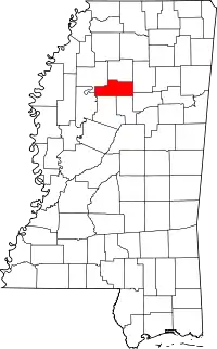
 Location within the U.S. state of Mississippi | |
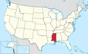
 Mississippi's location within the U.S. | |
| Coordinates: 33°46′N 89°48′W / 33.77°N 89.8°W | |
| Country | |
| State | |
| Founded | 1870 |
| Named for | Granada |
| Seat | Grenada |
| Largest city | Grenada |
| Area | |
| • Total | 449 sq mi (1,160 km2) |
| • Land | 422 sq mi (1,090 km2) |
| • Water | 27 sq mi (70 km2) 6.1% |
| Population (2020) | |
| • Total | 21,629 |
| • Density | 48/sq mi (19/km2) |
| Time zone | UTC−6 (Central) |
| • Summer (DST) | UTC−5 (CDT) |
| Congressional district | 2nd |
Grenada County is a county located in the U.S. state of Mississippi.[1] As of the 2020 Census, the population was 21,629.[2] Its county seat is Grenada.[3] The county was named for the province of Granada in southern Spain but spelled inaccurately.[4] Its western half is part of the Mississippi Delta. Cotton cultivation was important to its economy well into the 20th century.
The Grenada, MS Micropolitan Statistical Area includes all of Grenada County.
Geography
According to the U.S. Census Bureau, the county has a total area of 449 square miles (1,160 km2), of which 422 square miles (1,090 km2) is land and 27 square miles (70 km2) (6.1%) is water.[5]
Major highways
Adjacent counties
- Yalobusha County (north)
- Calhoun County (east)
- Webster County (southeast)
- Montgomery County (south)
- Carroll County (south)
- Leflore County (west)
- Tallahatchie County (northwest)
National protected area
Demographics
| Census | Pop. | Note | %± |
|---|---|---|---|
| 1870 | 10,751 | — | |
| 1880 | 12,071 | 12.3% | |
| 1890 | 14,974 | 24.0% | |
| 1900 | 14,112 | −5.8% | |
| 1910 | 15,727 | 11.4% | |
| 1920 | 13,607 | −13.5% | |
| 1930 | 16,802 | 23.5% | |
| 1940 | 19,052 | 13.4% | |
| 1950 | 18,830 | −1.2% | |
| 1960 | 18,409 | −2.2% | |
| 1970 | 19,854 | 7.8% | |
| 1980 | 21,043 | 6.0% | |
| 1990 | 21,555 | 2.4% | |
| 2000 | 23,263 | 7.9% | |
| 2010 | 21,906 | −5.8% | |
| 2020 | 21,629 | −1.3% | |
| U.S. Decennial Census[6] 1790-1960[7] 1900-1990[8] 1990-2000[9] 2010-2013[10] | |||
2020 census
| Race | Num. | Perc. |
|---|---|---|
| White (non-Hispanic) | 11,258 | 52.05% |
| Black or African American (non-Hispanic) | 9,352 | 43.24% |
| Native American | 29 | 0.13% |
| Asian | 84 | 0.39% |
| Pacific Islander | 2 | 0.01% |
| Other/Mixed | 594 | 2.75% |
| Hispanic or Latino | 310 | 1.43% |
As of the 2020 United States census, there were 21,629 people, 8,391 households, and 5,362 families residing in the county.
2019
As of the 2019 United States Census, there were 20,758 people living in the county.
55.3% were White, 42.9% Black or African American, 0.5% Asian, 0.3% Native American, and 1.1% of two or more races. 1.6% were Hispanic or Latino (of any race).
There were 8,391 households. The median income for a household in the county was $40,122.
Employment
According to the Greater Grenada Partnership, in 2020, the top 3 local employers were Modine, Lennox, and the Grenada School District[12] Top regional employers include Winchester, Toyota Mississippi, and Franklin Corporation. The Bureau of Labor Statistics reports that Grenada has added 1,600 direct jobs between 2011 and 2019.[13]
On April 20, 2021, Milwaukee Tool announced that the manufacturing company will expand in Mississippi by constructing an accessories manufacturing facility in Grenada County. The project is a $60 million corporate investment and will create 800 jobs at the Grenada location.[14]
According to a study commissioned by the Mississippi Development Authority and the Mississippi Department of Transportation, Grenada Railroad supports a total of 11,174 jobs, $1.3 billion in gross product and $1 billion in personal income.
Infrastructure
U.S. Senators Roger Wicker, R-Miss., and Cindy Hyde-Smith, R-Mississippi, announced the award of a $6.22 million grant to Grenada Railroad, LLC., to complete the final phase of a project to refurbish a rail line between Canton, Mississippi, and Memphis, Tennessee.[15] Work in progress on the northern 100-mile project is set for completion in Late 2023. The entire 188 miles of the Memphis, TN to Canton, MS line will be rated at 286,000 gross weight on rails (GWR) with an authorized speed of 40 MPH making it a Class III Short Line Railroad.[16]
Education
Grenada School District is the public school system.
Communities
City
- Grenada (county seat)
Census-designated places
Other unincorporated communities
Politics
| Year | Republican | Democratic | Third party | |||
|---|---|---|---|---|---|---|
| No. | % | No. | % | No. | % | |
| 2020 | 6,081 | 55.73% | 4,734 | 43.39% | 96 | 0.88% |
| 2016 | 5,970 | 56.79% | 4,424 | 42.08% | 119 | 1.13% |
| 2012 | 5,986 | 52.81% | 5,288 | 46.65% | 61 | 0.54% |
| 2008 | 6,234 | 55.07% | 5,029 | 44.42% | 58 | 0.51% |
| 2004 | 5,872 | 58.08% | 4,180 | 41.34% | 59 | 0.58% |
| 2000 | 5,129 | 54.65% | 4,163 | 44.36% | 93 | 0.99% |
| 1996 | 4,527 | 47.88% | 4,402 | 46.56% | 526 | 5.56% |
| 1992 | 4,721 | 49.34% | 4,203 | 43.93% | 644 | 6.73% |
| 1988 | 5,352 | 59.10% | 3,683 | 40.67% | 21 | 0.23% |
| 1984 | 5,181 | 60.80% | 3,325 | 39.02% | 15 | 0.18% |
| 1980 | 3,993 | 48.11% | 4,182 | 50.39% | 125 | 1.51% |
| 1976 | 3,569 | 50.84% | 3,263 | 46.48% | 188 | 2.68% |
| 1972 | 4,800 | 75.09% | 1,471 | 23.01% | 121 | 1.89% |
| 1968 | 718 | 10.11% | 2,050 | 28.86% | 4,335 | 61.03% |
| 1964 | 3,648 | 95.92% | 155 | 4.08% | 0 | 0.00% |
| 1960 | 682 | 29.11% | 529 | 22.58% | 1,132 | 48.31% |
| 1956 | 407 | 18.60% | 949 | 43.37% | 832 | 38.03% |
| 1952 | 1,000 | 46.00% | 1,174 | 54.00% | 0 | 0.00% |
| 1948 | 26 | 1.69% | 109 | 7.07% | 1,406 | 91.24% |
| 1944 | 117 | 7.85% | 1,373 | 92.15% | 0 | 0.00% |
| 1940 | 62 | 4.35% | 1,354 | 95.02% | 9 | 0.63% |
| 1936 | 13 | 1.03% | 1,245 | 98.97% | 0 | 0.00% |
| 1932 | 11 | 0.99% | 1,101 | 99.01% | 0 | 0.00% |
| 1928 | 40 | 3.35% | 1,155 | 96.65% | 0 | 0.00% |
| 1924 | 17 | 1.79% | 933 | 98.21% | 0 | 0.00% |
| 1920 | 12 | 2.17% | 533 | 96.38% | 8 | 1.45% |
| 1916 | 28 | 4.09% | 649 | 94.88% | 7 | 1.02% |
| 1912 | 3 | 0.61% | 469 | 94.75% | 23 | 4.65% |
See also
References
- ↑ "2019 Grenada Overview" (PDF). Greater Grenada Partnership. 2019. Archived (PDF) from the original on February 28, 2021. Retrieved July 7, 2021.
- ↑ "Census - Geography Profile: Grenada County, Mississippi". Retrieved January 8, 2023.
- ↑ "Find a County". National Association of Counties. Archived from the original on May 31, 2011. Retrieved June 7, 2011.
- ↑ Gannett, Henry (1905). The Origin of Certain Place Names in the United States. Govt. Print. Off. pp. 144.
- ↑ "2010 Census Gazetteer Files". United States Census Bureau. August 22, 2012. Archived from the original on September 28, 2013. Retrieved November 3, 2014.
- ↑ "U.S. Decennial Census". United States Census Bureau. Retrieved November 3, 2014.
- ↑ "Historical Census Browser". University of Virginia Library. Retrieved November 3, 2014.
- ↑ "Population of Counties by Decennial Census: 1900 to 1990". United States Census Bureau. Retrieved November 3, 2014.
- ↑ "Census 2000 PHC-T-4. Ranking Tables for Counties: 1990 and 2000" (PDF). United States Census Bureau. Archived (PDF) from the original on March 27, 2010. Retrieved November 3, 2014.
- ↑ "State & County QuickFacts". United States Census Bureau. Archived from the original on June 7, 2011. Retrieved September 3, 2013.
- ↑ "Explore Census Data". data.census.gov. Retrieved December 16, 2021.
- ↑ "Top Employers 2020" (PDF). Greater Grenada Partnership. 2020. Archived (PDF) from the original on September 19, 2020. Retrieved July 7, 2021.
- ↑ "Grenada Regional Workforce" (PDF). Greater Grenada Partnership. 2019. p. 1. Archived (PDF) from the original on September 19, 2020. Retrieved July 7, 2021.
- ↑ "Milwaukee Tool brings 800 new jobs to Grenada County | Grenada Economic Development District News". greatergrenada.com. Retrieved July 7, 2021.
- ↑ "$6.22 Million Grant for Grenada Railroad". Greater Grenada Partnership. October 10, 2020. Retrieved July 7, 2021.
- ↑ "Back on track: Rescued from oblivion, Grenada Railroad delivers vital opportunity". Greater Grenada Partnership. April 4, 2021. Retrieved July 7, 2021.
- ↑ Leip, David. "Dave Leip's Atlas of U.S. Presidential Elections". uselectionatlas.org. Retrieved March 4, 2018.