| Grindon | |
|---|---|
 The Grindon Sandhill as photographed from neighbouring Thorney Close, 2020 | |
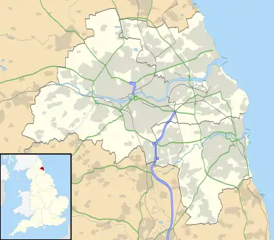
 Grindon Location within Tyne and Wear | |
| Metropolitan borough | |
| Metropolitan county | |
| Region | |
| Country | England |
| Sovereign state | United Kingdom |
| Post town | SUNDERLAND |
| Postcode district | SR4 |
| Dialling code | 0191 |
| Police | Northumbria |
| Fire | Tyne and Wear |
| Ambulance | North East |
| UK Parliament | |
Grindon is a suburb of Sunderland, Tyne and Wear, England.
Located three miles to the west of the city centre along Chester Road, Grindon originated as a Norman-era manor holding and was recreated into a post-war housing estate in the 20th century.
History
Historical linguists state that the name "Grindon" is derived from Old English and may mean "Green Hill", a reference to the geographic feature of the local Sandhill.[1]
The placename first appears in the Boldon Book dated from 1183 which states that the land was granted from the Bishop of Durham to Walter De Roth.[2][3]
In 2004 the electoral ward of Grindon was changed to include Thorney Close and is now known as the Sandhill Ward.
Pennywell Road is the location of the well-known independent school Grindon Hall Christian School.
References
- ↑ Mawer, Allen (1920). The Place-Names of Northumberland and Durham (PDF). Cambridge University Press. pp. 81–82. Retrieved 27 August 2022.
- ↑ Boldon Buke: A Survey of the Possessions of the See of Durham, Made by Order of Bishop Hugh Pudsey, in the Year M.C.L.XXXIII. Society. 1852.
- ↑ Snape, M. G.; Smith, David Michael; Kemp, B. R. (2002). English Episcopal Acta: Durham, 1153-1195. ISBN 978-0-19-726234-4.