| Grivola | |
|---|---|
 The Grivola | |
| Highest point | |
| Elevation | 3,969 m (13,022 ft) |
| Prominence | 714 m (2,343 ft)[1] |
| Isolation | 8.54 km (5.31 mi) |
| Listing | Alpine mountains above 3000 m |
| Coordinates | 45°35′48″N 7°15′52″E / 45.59667°N 7.26444°E |
| Geography | |
 Grivola Italy | |
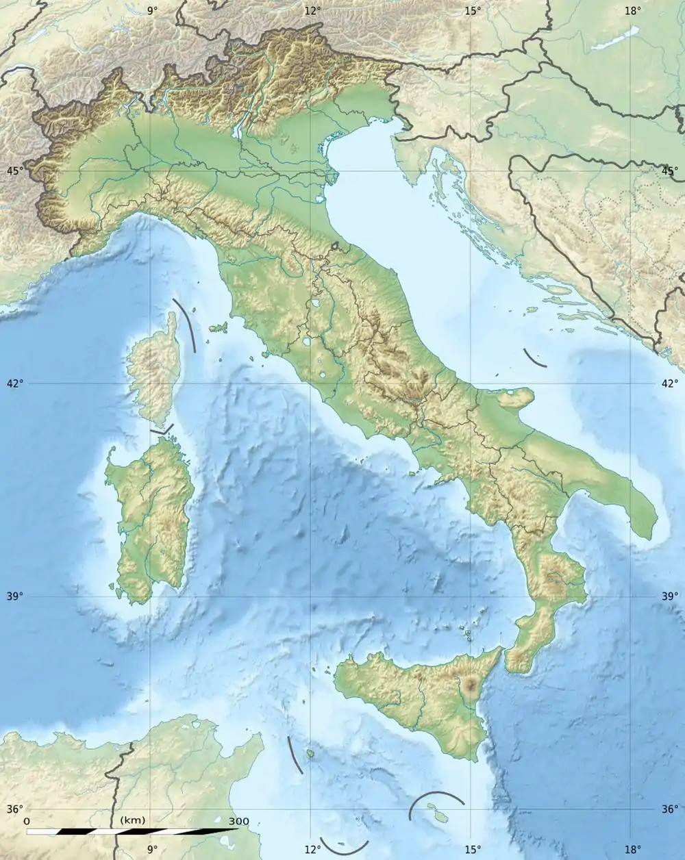
| Location | Aosta Valley, Italy |
| Parent range | Graian Alps |
| Climbing | |
| First ascent | 1859 by Ormsby, Bruce, Ambrogio Dayné, Cachat and Tairraz |
| Easiest route | From Col Lauson (3,296 m) |
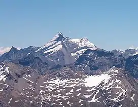
The Grivola (3,969 m) is a mountain in the Graian Alps in Italy. It lies between the Valsavarenche and the Cogne Valley.
Etymology
Grivola was named in different ways in the past:
- Pic de Cogne
- Grivolet
- Bec de Grivola
- Aiguille de Grivola
"Grivola" firstly appeared in 1845. Giuseppe Giacosa says it comes from Valdôtain griva, meaning song thrush[2] (French: grive). Joseph-Marie Henry indicated grivoline (French: grivoise), a pretty young girl, as for Jungfrau.[3] Paul-Louis Rousset says that the origin is gri in Valgrisenche Valdôtain, meaning "loose stones".[4]
SOIUSA classification
According to SOIUSA (International Standardized Mountain Subdivision of the Alps) the mountain is classified in the following way:[5]
- main part = Western Alps
- major sector = North-Western Alps
- section = Graian Alps
- subsection = North-eastern Graian Alps
- supergroup = Catena del Gran Paradiso
- group = Gruppo Grivola-Gran Serra
- subgroup = Sottogruppo della Grivola
- code = I/B-7.IV-A.3.b
Huts
- Rifugio Federico Chabod (2,750 m)
- Bivacco Luciano Gratton (3,198 m)
- Bivacco Mario Balzola (3,477 m)
- Bivacco Mario Gontier (2,309 m)
- Rifugio Vittorio Emanuele II (2,732 m)
- Rifugio Vittorio Sella (2,588 m)[6]
See also
References
- ↑ "Grivola, Italy". Peakbagger.com.
- ↑ Chissà perché si chiamano così, Tipografia Duc, Saint-Christophe, 2011, p. 118.
- ↑ Joseph-Marie Henry, Les ràye di soleil, ed. Mottes, Turin, 1935, p. 30.
- ↑ Paul-Louis Rousset, Ipotesi sulle radici preindoeuropee dei toponimi alpini, ed. Priuli & Verlucca, 1991, p. 62.
- ↑ Marazzi, Sergio (2005). Atlante Orografico delle Alpi. SOIUSA (in Italian). Priuli & Verlucca. p. 113. ISBN 978-88-8068-273-8.
- ↑ www.rifugiosella.com
Maps
- Italian official cartography (Istituto Geografico Militare - IGM); on-line version: www.pcn.minambiente.it
- I.G.C. (Istituto Geografico Centrale) - Carta dei sentieri e dei rifugi 1:50.000 scale n.3 Parco Nazionale del Gran Paradiso and 1:25.000 n.101 Gran Paradiso, La Grivola, Cogne
External links
This article is issued from Wikipedia. The text is licensed under Creative Commons - Attribution - Sharealike. Additional terms may apply for the media files.