| Gulliver River | |
|---|---|
 | |
| Location | |
| Country | New Zealand |
| Physical characteristics | |
| Source | |
| • location | Fiordland |
| Mouth | |
• location | Cleddau River |
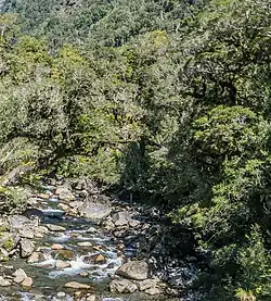
The Gulliver River is a river in the Fiordland area of New Zealand. It starts in the Darran Mountains near the Grave-Talbot Pass, and flows north and then west into the Cleddau River, which runs into Milford Sound.[1] The river was named in 1906 by W.G. Grave for Alf Grenfell, who had a nickname of "Gulliver".[2] A track along the Gulliver River from the Cleddau is suitable for day walks in summer and autumn[3] and can be extended on the Grave Talbot Track into the Espereance valley, past the 59 m (194 ft) high De Lambert Falls and over the Grave Talbot Pass.[4]
In 1975 three remaining kākāpō in the Esperance and Gulliver Valleys were moved to Maud Island.[5]
Esperance River
The Esperance River is a 3 km (1.9 mi) tributary flowing from the west off Mount Isolation.[6] Large rimu and beech trees line the river up to about the 500 m (1,600 ft) contour.[7]
See also
References
- ↑ Roger Smith, GeographX (2005). The Geographic Atlas of New Zealand. Robbie Burton. pp. maps 200, 212. ISBN 1-877333-20-4.
- ↑ Discover New Zealand:A Wises Guide (9th ed.). 1994. p. 459.
- ↑ "Day Walks". Archived from the original on 9 June 2009. Retrieved 13 July 2009.
- ↑ "Gulliver River". climbnz.org.nz. Retrieved 30 March 2018.
- ↑ Gray, Richard (1977). "The habitat, food and feeding ecology of kakapo in Fiordland" (PDF).
- ↑ "Esperance River, Southland - NZ Topo Map". NZ Topo Map. Retrieved 30 March 2018.
- ↑ "Milford Sound Walks". Milford Sound. Retrieved 30 March 2018.
- Land Information New Zealand - Search for Place Names
44°42′26″S 167°58′33″E / 44.70722°S 167.97583°E