Guryongpo
구룡포 | |
|---|---|
Town | |
| Korean transcription(s) | |
| • Hangul | 구룡포읍 |
| • Hanja | 九龍浦邑 |
| • Revised Romanization | Guryongpo-eup |
| • McCune–Reischauer | Kuryongp'o-ŭp |
 | |
| Country | South Korea |
| Province | North Gyeongsang |
| City | Pohang |
| Non-autonomous District | Nam-gu |
| Administrative divisions | 10 beopjeongni, 28 hangjeongni and 209 ban |
| Area | |
| • Total | 45.17 km2 (17.44 sq mi) |
| Population (2015.5) | |
| • Total | 9,099 |
| • Density | 200/km2 (520/sq mi) |
| Website | Guryongpo Town |
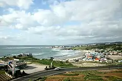
Guryongpo is a town, or eup in Nam-gu, Pohang, North Gyeongsang Province, South Korea. The township Changju-myeon was upgraded to the town Guryongpo-eup in 1942. Guryongpo Town Office is located in Hudong-ri.
Communities
Guryongpo-eup is divided into 10 villages (ri).[1]
| Hangul | Hanja | |
|---|---|---|
| Guryongpo-ri | 구룡포리 | 九龍浦里 |
| Samjeong-ri | 삼정리 | 三政里 |
| Seokbyeong-ri | 석병리 | 石屛里 |
| Seongdong-ri | 성동리 | 城洞里 |
| Gupyeong-ri | 구평리 | 邱坪里 |
| Janggil-ri | 장길리 | 長吉里 |
| Hajeong-ri | 하정리 | 河亭里 |
| Byeongpo-ri | 병포리 | 柄浦里 |
| Hudong-ri | 후동리 | 厚洞里 |
| Nultae-ri | 눌태리 | 訥台里 |
References
- ↑ "Map of Guryongpo". Pohang City. Archived from the original on 20 June 2015. Retrieved 19 June 2015.
Wikimedia Commons has media related to Guryongpo.
External links
- Official website (in Korean)
This article is issued from Wikipedia. The text is licensed under Creative Commons - Attribution - Sharealike. Additional terms may apply for the media files.