Hamden, New Jersey | |
|---|---|
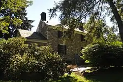
 Captain Jacob Gearhart House | |
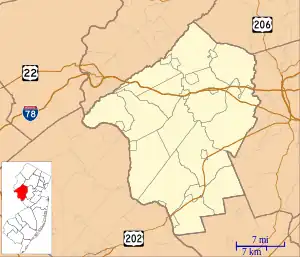
 Hamden Hamden's location in Hunterdon County (Inset: Hunterdon County in New Jersey)  Hamden Hamden (New Jersey)  Hamden Hamden (the United States) | |
| Coordinates: 40°36′12″N 74°54′2″W / 40.60333°N 74.90056°W | |
| Country | |
| State | |
| County | Hunterdon |
| Township | Clinton |
| Elevation | 51 m (167 ft) |
| Time zone | UTC−05:00 (Eastern (EST)) |
| • Summer (DST) | UTC−04:00 (EDT) |
| GNIS feature ID | 876902[1] |
Hamden is an unincorporated community located within Clinton Township, in Hunterdon County, in the U.S. state of New Jersey.[1][2][3]
The community is centered just east of the South Branch Raritan River and is situated 3.0 miles (4.8 km) west of the Round Valley Reservoir and 3.0 miles (4.8 km) south-southeast of the Spruce Run Reservoir.[4]
History
%252C_Flemington%252C_Hunterdon_County%252C_NJ_HAER_NJ%252C10-CLIN.V%252C1-7.tif.jpg.webp)
The 1,000-acre (400 ha) Hamden Tract was purchased by Phillip and John Grandin in 1759. The Grandin Grist & Fulling-Mills, a blacksmith shop, and Abbott's Tavern were located here.[5] The farmhouse of Jacob Gearhart (1735–1813), captain in the American Revolutionary War, is located nearby.[6] The 1858 Fink-Type Truss Bridge (Hamden Bridge), listed on the National Register of Historic Places, crossed the river here, until it collapsed in 1978.[7]
References
- 1 2 3 "Hamden". Geographic Names Information System. United States Geological Survey, United States Department of the Interior.
- ↑ Locality Search, State of New Jersey. Accessed January 1, 2015.
- ↑ Areas covering the point (-74.900556,40.603333), MapIt. Accessed January 2, 2015.
- ↑ N 40.60333 W 74.90056, ACME Mapper. Accessed January 2, 2015.
- ↑ Township of Clinton, New Jersey. "The Village of Hamden, New Jersey". The Historical Marker Database.
- ↑ "Valinski Section of the South Branch Reservation" (PDF). Division of Parks & Recreation, Hunterdon County, New Jersey.
- ↑ "Fink Through-Truss Bridge (Hamden Bridge)". Historic American Engineering Record. Washington, D.C.: Library of Congress. 1984.
