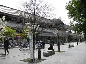
Hanazono Station 花園駅 | |||||||||||
|---|---|---|---|---|---|---|---|---|---|---|---|
 | |||||||||||
| General information | |||||||||||
| Location | Ukyō, Kyoto, Kyoto Japan | ||||||||||
| Operated by | JR West | ||||||||||
| Line(s) | Sagano Line | ||||||||||
| Platforms | Island platform | ||||||||||
| Tracks | 2 | ||||||||||
| Connections | Bus stop | ||||||||||
| Construction | |||||||||||
| Structure type | Elevated | ||||||||||
| Accessible | Yes | ||||||||||
| Other information | |||||||||||
| Station code | JR-E06 | ||||||||||
| History | |||||||||||
| Opened | 1898 | ||||||||||
| Services | |||||||||||
| |||||||||||
Hanazono Station (花園駅, Hanazono-eki) is a train station in Ukyo-ku, Kyoto, Japan. The station (and surrounding neighborhood) are named for Emperor Hanazono, who had a palace in the area, now the Myōshin-ji temple complex.
Line
- West Japan Railway Company (JR West)
Layout
The elevated station has an island platform with two tracks.[1]
| 1 | ■ Sagano Line | for Kyoto |
| 2 | ■ Sagano Line | for Kameoka, Sonobe and Fukuchiyama |
History
Hanazono Station opened on 1 January 1898, less than one year after the opening of the Kyoto Railway (predecessor of the San'in Main Line).[2]
Station numbering was introduced in March 2018 with Hanazono being assigned station number JR-E06.[3][4]
Surrounding area
Just to the north and east is the major temple complex of Myōshin-ji, and the affiliated Hanazono University (to the east, actually closer to Emmachi Station).
References
- ↑ "花園駅 構内図". Retrieved October 20, 2013.
- ↑ Ishino, Tetsu; et al., eds. (1998). 停車場変遷大事典 国鉄・JR編 [Station Transition Directory – JNR/JR] (in Japanese). Vol. II. Tokyo: JTB Corporation. p. 299. ISBN 4-533-02980-9.
- ↑ "近畿エリアの12路線 のべ300駅に「駅ナンバー」を導入します!" ["Station numbers" will be introduced at a total of 300 stations on 12 lines in the Kinki area!]. westjr.co.jp (in Japanese). 20 July 2016. Archived from the original on 16 November 2022. Retrieved 30 December 2022.
- ↑ "「駅ナンバー」一覧表" ["Station number" list] (PDF). westjr.co.jp (in Japanese). 20 July 2016. Archived from the original (PDF) on 16 November 2022. Retrieved 30 December 2022.
35°1′7.01″N 135°43′4.01″E / 35.0186139°N 135.7177806°E
This article is issued from Wikipedia. The text is licensed under Creative Commons - Attribution - Sharealike. Additional terms may apply for the media files.