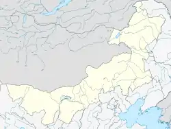
Hanggai
杭盖村 • ᠬᠠᠩᠭᠠᠢ | |
|---|---|
 Hanggai Location in Inner Mongolia | |
| Coordinates: 40°32′50″N 111°11′45″E / 40.5472°N 111.1959°E | |
| Country | China |
| Autonomous Region | Inner Mongolia |
| Prefecture-level city | Hohhot |
| Banner | Tumed Left Banner |
| Township | Taban Sain |
Hanggai (Mongolian: ᠬᠠᠩᠭᠠᠢ, Хангай; Chinese: 杭盖村; pinyin: Hánggàicūn) is a village in Taban Sain Township, Tumot Left Banner, Hohhot, Inner Mongolia Autonomous Region, China.[1][2][3] Its population is about 1500, mostly Han Chinese, with some Mongol families.
References
- ↑ 2016年统计用区划代码和城乡划分代码:塔布赛乡 [2016 Statistical Area Numbers and Rural-Urban Area Numbers: Tabusai Township] (in Simplified Chinese). National Bureau of Statistics of the People's Republic of China. 2016. Retrieved 13 July 2018.
150121208213 220 杭盖村委会
- ↑ 塔布赛乡 [Tabusai Township] (in Simplified Chinese). XZQH.org. 3 April 2013. Retrieved 13 July 2018.
【2011年代码及城乡分类】150121208:{...}~213 220杭盖村{...
} - ↑ 土默特左旗苜蓿基地突发草地螟虫害. Hohhot Agricultural Information Network. 17 June 2013. Archived from the original on 15 February 2016. Retrieved 27 August 2015.
This article is issued from Wikipedia. The text is licensed under Creative Commons - Attribution - Sharealike. Additional terms may apply for the media files.