 View of Harøya (looking north) | |
 | |
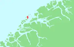
 Harøya Location of the island  Harøya Harøya (Norway) | |
| Geography | |
|---|---|
| Location | Møre og Romsdal, Norway |
| Coordinates | 62°46′11″N 6°26′29″E / 62.7697°N 06.4415°E |
| Area | 13.6 km2 (5.3 sq mi) |
| Length | 7 km (4.3 mi) |
| Width | 3 km (1.9 mi) |
| Highest elevation | 156 m (512 ft) |
| Highest point | Harøyburet |
| Administration | |
Norway | |
| County | Møre og Romsdal |
| Municipality | Ålesund Municipality |
| Official name | Harøya Wetlands System |
| Designated | 18 March 1996 |
| Reference no. | 806[1] |
Harøya is a swampy island in Ålesund Municipality in Møre og Romsdal county, Norway. At 13.6 square kilometres (5.3 sq mi), it is the largest island in the municipality. The island is located between the islands of Finnøya (to the northeast) and Fjørtofta (to the southwest).
Steinshamn, the municipal center, is located at the north end of the island where there is a causeway connecting it to the neighboring island of Finnøya. The village of Myklebost is located at the south end of the island, where there are ferry connections to Dryna (in Midsund) and Brattvåg and Fjørtofta (in Haram). Harøy Church is located in the center of the island,[2] just north of the Lomstjønna Nature Reserve.[3]
The new Nordøyvegen bridge and tunnel project will connect the island of Harøy to the mainland when it is completed.
See also
References
- ↑ "Harøya Wetlands System". Ramsar Sites Information Service. Retrieved 25 April 2018.
- ↑ Store norske leksikon. "Harøya" (in Norwegian). Retrieved 2010-10-22.
- ↑ "Lomstjønna". Mijlø-direktoratet. Retrieved August 8, 2017.